the 7th International Conference on Debris-Flow Hazards Mitigation (Golden, USA)
TOTAL 135 papers
001
Numerical investigation of particle size segregation in saturated granular flows using CFD-DEM coupling approach
Particle size segregation is a common feature in debris-flow deposits and is assumed to develop in a similar way as in dry granular flows where fluid forces are neglected. Solid-fluid coupling however is a defining feature of debris flows and fluid forces must therefore be accounted for in modelling for the segregation that develops therein. This paper presents a numerical investigation of the mechanisms of segregation under the influence of fluid forces. For this, a segment of a fully submerged bi-disperse steady granular flow is simulated using the CFD-DEM method. The solid-fluid interactions come in the form of buoyancy and fluid drag force. It is found that the presence of the fluid generally retards the rate and quality of segregation primarily by promoting the formation of a plug flow in the stream-wise velocity profile. The plug flow region forms at the free surface where it significantly reduces or zeroes out the shear rates thus inhibiting the main mechanisms of segregation, i.e. kinetic sieving and squeeze expulsion, to take place. It is inferred that the rapid shearing that occurs near the base promotes segregation but is unable to proceed towards the free surface due to the presence of the plug flow region that serves as a barrier. The quality of submerged segregation improves at lower angles where the plug flow region is minimized and the usual parabolic shear profile develops.
002
Erosion by experimental debris flows: particle size effects
The mobilization of surface material by particle-laden flows involves phenomenology that cross multiple scales: particle-scale interactions and mesoscopic stresses have significant implications for landscape evolution and associated hazard mitigation issues. Here, we consider the problem of erosion of bed materials by debris flows – flows of boulders, gravel, sand, fine particles, and fluids – as they entrain soils and rocks from steep hillsides. In this paper we report results from laboratory experiments investigating the effect of changing coarse particle concentration in a dry “debris flow” on the erosion of a bed over which it flows. We find that increasing the fraction of coarse particles in the bed often increases the bed erosion. However, for some systems, the details are noisier and harder to discern. We associate the variable erosion and noisiness in part with the competing dynamics of small scale interactions, such as the coarse grain impacts, and larger scale details, such as those related to angles of repose. We also present preliminary results measuring instantaneous erosion rates and demonstrate that size dependence of the erosion rates can vary considerably from that of the net erosion. We conclude by summarizing some limitations of our experiments and ongoing next steps to address these limitations.
003
How does particle-size segregation affect the fluidity of multi-granular debris flows?
It is essential to consider the fluidity of a debris-flow front when calculating its impact. Here, we flume-tested monogranular and bigranular debris flows, and compared the results to those of numerical simulations. We used sand particles with diameters of 0.29 and 0.14 cm at two mixing ratios, of 50% and 50% (5:5), and 30% and 70% (3:7), respectively. Particle segregation was recorded using a high-speed video camera. We evaluated the fronts of debris flows at 0.5-s intervals. We then numerically simulated one- dimensional debris flows under the same conditions, and we used the mean particle diameter when simulating mixed-diameter flows. For monogranular debris flows, the experimental and simulated results were in good agreement in terms of flow depth, front velocity, and flux, but the bigranular debris flows were not well-simulated; the simulated flow depth was less than that found experimentally, and the front velocity and flux were greater. The differences may be attributable to the fact that the dominant shear stress was caused by the concentration of smaller sediment particles in the lower flow layers; such inverse gradations were detected in the debris flow bodies. In this situation, most shear stress is supported by smaller particles in the lower layers; the debris-flow characteristics become similar to those of monogranular flows. Consequently, the calculated front velocities were underestimated; particle segregation at the front of bigranular debris flows did not affect fluidity either initially or over time.
004

Valid debris-flow models must avoid hot starts
Debris-flow experiments and models commonly use “hot-start” initial conditions in which downslope motion begins when a large force imbalance is abruptly imposed. By contrast, initiation of natural debris flows almost invariably results from small perturbations of static force balances that apply to debris masses poised in steep channels or on steep slopes. Models that neglect these static balances may violate physical law. Here we assess how the effects of hot starts are manifested in physical experiments, analytical dam-break models, and numerical models in which frictional resistance is too small to satisfy static force balances in debris-flow source areas. We then outline a numerical modeling framework that avoids use of hot starts. In this framework an initial static force balance is gradually perturbed by increasing pore-fluid pressure that may trigger the onset of debris motion. Subsequent increases in pore-fluid pressure, driven by debris motion, may then reduce the debris frictional strength, leading to high flow mobility.
005
Role of topography on the volume of material eroded by debris flows, The
Prediction of sediment volume of debris flows is the most important factor for designing debris-flow control structures or estimating debris-flow prone area. It has been considered that debris-flow volume may increase due to erosion at the steep channel. So, clarifying erosion volume (in this study, erosion volume is sediment volume in the channel eroded by debris flow) due to debris flow is a key information to mitigate debris-flow disasters. This study hypothesized that erosion volume might be controlled by topography, because it can be thought that the transport capacity of debris flow increased with the increase of stream bed gradient and contributing area. In Recent field observations by Schürch et al. (2011) supported to this hypothesis and showed a correlation, showing the correlation between flow depth and magnitude of erosion. However, detailed information about spatial pattern of erosion depth due to debris flow is still limited. In this study, spatial pattern measurements of erosion volume due to debris flows for 16 debris flows in Japan. LiDAR data taken before and after the debris flow was used for the comparison. Then, examination of stream bed gradient and drainage area derived from the LiDAR dataset was performed. The study found that erosion volume of debris flow increases as slope of stream bed gradient and drainage area increases. The study proposed methods to predict erosion volume due to debris flow using stream bed gradient and drainage area based on the probabilistic relationship between measured erosion volume and topography. That is, it is considered that the topography derived from LiDAR can be used as one of the indicators used in estimating volume of future debris flow.
006
Numerical investigation of deposition mechanism of submarine debris flow
Submarine debris flow can damage oil and gas transport pipelines with potentially adverse consequences to the environment and to the industrial activity itself. The deposition process of submarine debris flow, which is related to the flow viscosity, is complex due to the slurry diffusion process that happens during the interaction of water and slurry. In addition, a quantitative characterization of the characterize the flow mechanism as influenced by the material density during the deposition process remains a scientific challenge. To fundamentally understand the mechanisms of solid-fluid interactions in fast-flowing submarine debris flows, a series of three-dimensional (3D) numerical simulations using Computational Fluid Dynamics (CFD) were conducted. The Herschel- Bulkley (HB) model was used to define the submarine slurry’s rheological characterization as calibrate through simple rheological experiment. Results reveal that deposition is a mass diffusion process. Shear stress at the bottom and at the top of the slurry leads to velocity differences in the vertical direction which in turn generates a huge vortex, which contributed to a separation of slurry into two parts: the frontal head, and the tail. The velocity difference in vertical direction is helpful for hydroplaning. For higher slurry viscosity case, the flow profile is longer and thicker with a front head that has a lower averaged densities and sharper head angles. In addition, highly viscous slurries have lower average frontal velocities during the deposition process. The mixture density decreases in two stages: quick decreasing stage and stable decreasing stage. In the first stage, the slurry expands quicker than the second stage. Higher viscosities also lead to larger volume expansions which consequently leads to quicker density decrease.
007
Compressibility of solid phase of debris flow and erosion rate
The change in sediment concentration of debris flow causes erosion and sedimentation of the solid phase of debris flows. Moreover, the changing affects the mobility of the flow. Therefore, knowledge of the mechanism of the changing is important to understand the mechanism of debris flow. The changing can be considered as compressibility of the flow of the solid phase. We developed a constitutive equation set of debris flow by concerning energy dissipation. A part of the energy dissipation is due to inelastic collision of particles. This process must be compressible. Therefore, we reinvestigate the process of the inelastic collisions and the effect to the compressibility. As the result, we lead internal energy to control the compressibility and so-called erosion rate equation. According to the erosion rate equation, it depends on bed gradient and energy loss gradient. A flume test is conducted to evaluate the erosion rate equation. by using a prismatic steep slope channel, which inclination is set at 12 degrees. By comparison of experimental result with the erosion rate equation, it is found that the difference between energy gradient and bed gradient to control the erosion/deposition is not so large. It means that the erosion/deposition might be very much sensitive against the unbalance of the energy gradient and bed gradient.
008
Commonalities between debris flows and flow failures
Debris flow and flow failure are terms used to describe large displacement slope failures. The initiation or triggering often differs due to the nature and state of the material, but once triggered these two failure mechanisms both tend to behave like a Bingham plastic exhibiting a yield strength and a strain-rate dependent strength. In this paper the rheology of these failures is examined and compared to field data and lab data to find commonalities. A future goal is to move towards a common definition of the physics and a joint empirical database for improved statistics and predictive models. The authors own field investigations in Chile and lab investigations using shake table experiments will be reviewed along with studies by other researchers.
009
Soil characteristics of long-traveling landslides and a hybrid model to predict travel distance
When landslides liquefy and sediment movement takes on characteristics of a debris flow, travel distance increases, expanding the range of potential damage. Clarifying the liquefaction mechanism for such phenomena and predicting travel distance are important for evaluating hard and soft measures for controlling landslide damage. The authors have compiled data on landslide travel distance in Japan, used the travel coefficient (Tr) to classify movement of landslide soil masses, and investigated the relationship between landslide movement and soil characteristics with the goal of clarifying the liquefaction mechanism. These results were used to analyze the soil characteristics of long-traveling landslides. The hybrid model developed by Satofuka (2004) was used as a liquefaction model and sensitivity analysis was conducted for the model parameters. Model validity was evaluated by comparing the simulated and actual sediment flow, deposition, and displacement velocity of a landslide that occurred in Niigata Prefecture in March 2004.
010

Research on the movable solid materials under seepage flow effect in debris flow source area, The
Solid materials distributed on the surface of watershed transform to debris flow under seepage flow effect is one of the most common disaster type in the mountainous area, especially in the Longmen Fault regions, China. The high frequency of debris- flow event takes a big menace to local people’s safety of life and properties directly, as well as the reconstruction work. Currently, more theory and experiment researches are concentrated on solid materials instability mechanism, debris-flow initiation, movement process of slope-gully system, but fewer research are focused on the moveable critical condition of solid materials under hydrodynamic condition as seepage flow and surface flow. Thus, based on the mechanical balance, through define the theory of the movable solid materials firstly. Then, take a comparison with traditional terms as loosen solid materials, dynamic reserves and efficient solid materials, it found that solid materials move or not is a mechanical problem rather than traditional definition. Thirdly, on the condition of saturated seepage flow, according to setting up geological model and taking mechanical analysis, it gained dynamical formula and resistance formula respectively, then, give confined parameters, it found a liner distribution of dynamical value and resistance value versus depth when the geology model is homogeneous and the seepage flow saturated in whole layer.
011
Overcoming barriers to progress in seismic monitoring and characterization of debris flows and lahars
Debris flows generate seismic signals that contain valuable information about events as they unfold. Though seismic waves have been used for along-channel debris-flow and lahar monitoring systems for decades, it has proven difficult to move beyond detection to more quantitative characterizations of flow parameters and event size. This is for two primary reasons: (1) our limited understanding of how the radiated wavefield relates to debris flow characteristics and dynamics, and (2) difficulties quantifying the effects of heterogeneous shallow earth structure on the observed wavefield. The latter issue, essentially our inability to sufficiently separate seismic path effects from source information, is a barrier to improving our understanding of the first issue. We review the progress that has been made toward establishing the theory, models and methods required to use seismic observations to make quantitative measurements of flows and summarize the practical, social, and scientific barriers to progress. We discuss some specific ongoing efforts to overcome some of these barriers, with a focus on how we are using large-scale seismic experiments at the U.S. Geological Survey debris-flow flume to develop methods for directly measuring path effects and to develop and validate theoretical debris flow seismicity models.
012
Topographic change detection at Chalk Cliffs, Colorado, USA, using airborne lidar and UAS-based Structure-from-Motion photogrammetry
The Chalk Cliffs debris-flow site is a small headwater catchment incised into highly fractured and hydrothermally altered quartz monzonite in a semiarid climate. Over half of the extremely steep basin is exposed bedrock. Debris flows occur multiple times per year in response to rainstorm events, typically during the summer monsoon season. The frequency of debris flows, and the uniformity of the underlying rock, make Chalk Cliffs an ideal study catchment for translating mechanistic understanding of natural debris flows to other sites. A 2008 National Center for Airborne Laser Mapping (NCALM) airborne lidar survey provides baseline topography for the site; however, heretofore there has been no systematic effort to collect repeat topography of the entire site. Starting in May 2018, we made repeat surveys of the basin with an unmanned aircraft system (UAS). The UAS-based imagery was processed into (x, y, z) point clouds using Structure-from-Motion (SfM) photogrammetry. We georegistered the point clouds using 12 ground control points placed within and around the study basin. In this study we compare the lidar with one SfM point cloud to assess topographic change over a 10-year time period. The difference map provides observational data relevant to understanding sediment provenance and transport at the Chalk Cliffs. The difference image indicates erosion of colluvial surfaces, with limited deposition in the survey area. Some colluvial hillslopes show spatially uniform erosion while others experienced concentrated erosion of up to 3 m depth over a 10-year period.
013
Forecasting and seismic detection of debris flows in pro-glacial rivers at Mount Rainier National Park, Washington, USA
The glaciated Mount Rainier volcano in Southwestern Washington State (USA) has a rich history of outburst floods and debris flows that have adversely impacted infrastructure at Mount Rainier National Park in the 20th and 21st century. Retreating glaciers leave behind vast amounts of unconsolidated till that is easily mobilized during high precipitation intensity fall storms and during outburst floods during warm summer months. At least 60 debris flows and outburst floods have been documented between 1926 and 2017 at Mount Rainier. Debris-flow activity has led to the closure of campgrounds and visitor destinations, which has limited visitor access to large swaths of the park. After a relative lull in activity between 2006 and 2014, the historically debris-flow-prone South Tahoma Glacier released two separate sequences of debris flows in 2015, possibly signaling a reawakening in activity. The August 13, 2015 debris flow was especially well documented by park visitors, seismographs and, most interestingly, a soundscape monitor which recorded an anomalous decrease in river noise prior to the arrival of the first debris flow. The seismograph near Tahoma Creek accurately recorded the passage of each debris-flow surge. Using the day of and historic antecedent weather conditions on past debris-flow days, we have developed a debris-flow hazard model to help predict those days with a higher relative hazard for debris-flow activity park-wide based on prevailing and forecasted weather conditions. Debris flows are detected in near- real-time using the USGS Real-time Seismic Amplitude Measurement (RSAM) tool. If an event is detected, we can then provide alerts to employees and visitors working and recreating in the areas downstream to evacuate. Our goal is to accurately forecast the hazard of a debris flow up to seven days ahead of time and then use RSAM to detect debris flows within minutes of their genesis.
014
Deciphering sediment dynamics in a debris flow catchment: insights from instrumental monitoring and high-resolution topography
In mountainous catchments, the quantification of sediment yield is of paramount relevance for land-use planning and design of sediment control structures. However, deciphering the contribution of the different sediment transport processes (debris flows, debris floods and bedload transport) is often challenging as they are strongly controlled by basin morphometry, hydrological regime, and sediment supply. Therefore, long-term instrumental monitoring through catchment-scale sensor networks can provide precious information, especially if coupled with high-resolution topographical surveys. The Gadria catchment, located in the eastern Italian Alps, offers the possibility to perform a systematic monitoring of sediment transport processes. This catchment typically features several low-magnitude flood episodes and a few debris-flow events per year, from late spring to early fall. Starting from 2011, various instruments mainly devoted to debris-flow detection (geophones, video cameras, flow stage sensors) have been installed along the main channel, just upstream of a retention basin. High-resolution topographical surveys of the retention basin are carried out each year, at the beginning and at the end of the summer season and after debris-flow events. Rainfall is measured in the intermediate part of the catchment and in the headwaters, while PIT-tracing of bedload was performed in the main channel. In this work, we present the reconstruction of the sediment dynamics at the catchment scale during the 2014 and 2015 monitoring seasons. Instrumental monitoring was used to estimate the contribution of the different flow processes, and data from topographical surveys to quantify the transported volumes. Results show that (i) coarse sediment yield is driven by sporadic debris flows while flood events allow the continuous fine-sediment migration along the channel network; (ii) volume estimations may be significantly different – up to 30% lower – if performed through a DEM of Difference (DoD) analysis of the retention basin or by analysing monitoring data; (iii) a multi-parametric monitoring is needed to decipher sediment dynamics at catchment scale.
015
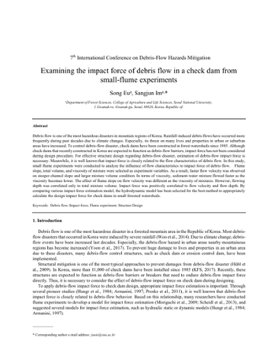
Examining the impact force of debris flow in a check dam from small-flume experiments
Debris flow is one of the most hazardous disasters in mountain regions of Korea. Rainfall-induced debris flows have occurred more frequently during past decades due to climate changes. Especially, its threat on many lives and properties in urban or suburban areas have increased. To control debris-flow disaster, check dams have been constructed in forest watersheds since 1985. Although check dams that recently constructed in Korea are expected to function as debris-flow barriers, impact force has not been considered during design procedure. For effective structure design regarding debris-flow disaster, estimation of debris-flow impact force is necessary. Meanwhile, it is well known that impact force is closely related to the flow characteristics of debris flow. In this study, small flume experiments were conducted to analyze the influence of flow characteristics to impact force of debris flow. Flume slope, total volume, and viscosity of mixture were selected as experiment variables. As a result, faster flow velocity was observed on steeper channel slope and larger mixture volume condition. In terms of viscosity, sediment-water mixture flowed faster as the viscosity becomes lower. The effect of flume slope on flow velocity was different as the viscosity of mixtures. However, flowing depth was correlated only to total mixture volume. Impact force was positively correlated to flow velocity and flow depth. By comparing various impact force estimation model, the hydrodynamic model has been selected for the best method to appropriately calculate the design impact force for check dams in small forested watersheds.
016
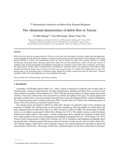
Vibrational characteristics of debris flow in Taiwan, The
Debris flows have become a common disaster in Taiwan in recent years since the impacts of extreme weathers has been aggravated. To protect people from the debris-flow disasters, a monitoring and warning system was developed by Soil and Water Conservation Bureau (SWCB) in Taiwan. The rainfall-based criteria are used in Taiwan for debris flow warning. Different to rainfall measurement, the ground surface vibrational signal from a debris flow has been studied more widely in recent years. Sensors of geophone (short period seismograph) and broadband seismograph are commonly used for debris flow monitoring. In this paper, the signal analysis of debris flows was performed by calculating the vibrational energy. The comparison of the analysis results indicated that when the energy ratios of at least two of the axes are greater than 1.12, a debris flow is highly likely to occur. The starting point in the increasing trend of vibrational energy implied the possible warning time point for debris flow. Vibration examples of debris flow and earthquakes were also compared in this paper.
017

Monitoring and modeling of debris-flow surges at the Lattenbach creek, Austria
Debris-flow events are often comprised by a sequence of surges, sometimes termed roll waves. The reason for this surging behavior is still a matter of debate. Explanations include the growth of hydraulic instabilities, periodic sediment deposition and release, or grain size sorting. Also, the shape and the velocity of single surges and the implications for hazard mitigation are hard to predict. Here we present results of several years of monitoring debris-flow events at the Lattenbach creek (AUT). The monitoring system includes radar sensors for measuring flow depth at different locations along the channel, as well as a 2-D rotational laser sensor installed over a fixed cross-section that yields a 3-D surface model of the passing debris-flow event. We find that the debris flows at Lattenbach creek exhibited surges for each observed event. The celerity of the surges were up to twice as high as the front velocity. Often, the first surges had highest flow depth and discharge, and showed an irregular geometry. Video recordings reveal that this might be connected to the presence of large boulders and woody debris. On the contrary, the shape of the surges in the second half of the flow, which carried smaller grain sizes and less woody debris, were rather regular and showed a striking geometric similarity, but still high velocities. We tested a recently derived wave equation based on hydraulic theory and found that the shape of these regular roll waves can be reasonably reproduced by that model. The results of our monitoring efforts aim to improve our understanding of the surging behavior of debris flows and provide data for model testing for the scientific community.
018
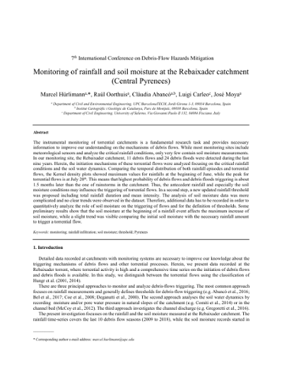
Monitoring of rainfall and soil moisture at the Rebaixader catchment (Central Pyrenees)
The instrumental monitoring of torrential catchments is a fundamental research task and provides necessary information to improve our understanding on the mechanisms of debris flows. While most monitoring sites include meteorological sensors and analyze the critical rainfall conditions, only very few contain soil moisture measurements. In our monitoring site, the Rebaixader catchment, 11 debris flows and 24 debris floods were detected during the last nine years. Herein, the initiation mechanisms of these torrential flows were analyzed focusing on the critical rainfall conditions and the soil water dynamics. Comparing the temporal distribution of both rainfall episodes and torrential flows, the Kernel density plots showed maximum values for rainfalls at the beginning of June, while the peak for torrential flows is at July 20th. This means that highest probability of debris flows and debris floods triggering is about 1.5 months later than the one of rainstorms in the catchment. Thus, the antecedent rainfall and especially the soil moisture conditions may influence the triggering of torrential flows. In a second step, a new updated rainfall threshold was proposed including total rainfall duration and mean intensity. The analysis of soil moisture data was more complicated and no clear trends were observed in the dataset. Therefore, additional data has to be recorded in order to quantitatively analyze the role of soil moisture on the triggering of flows and for the definition of thresholds. Some preliminary results show that the soil moisture at the beginning of a rainfall event affects the maximum increase of soil moisture, while a slight trend was visible comparing the initial soil moisture with the necessary rainfall amount to trigger a torrential flow.
019
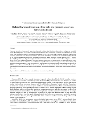
Debris flow monitoring using load cells and pressure sensors on Sakura-jima Island
Numerous debris flows have recently taken place frequently in Sakura-jima Island located at southwest in Japan due to rainfall events after ash deposition due to volcanic activities since 2010. Debris-flow measurement system with loadcell and pressure sensor (DFLP) had been applied for debris-flow monitoring (Osaka et al., 2014). In present study, a modified monitoring DELP system using load cells and a stainless-steel plate is employed. Mass density and sediment concentration are calculated using data obtained by the DFLP system and data measured by ultrasonic level meter and surface velocity by of image analyses of CCTV camera. (Results) Temporal changes of specific weight, sediment concentration and sediment volume of debris-flow in Nojiri and Arimura Rivers in 2014 were well measured using DFLP system. Sediment concentration and specific weight were calculated in both rivers, and there are at least 10 data in Arimura River and 8 data in Nojiri River for calculations of temporal changes of mass density and sediment concentration since 2012 and 2014, respectively. Averaged sediment concentration near peak discharge are calculated as 0.441 in Arimura River and 0.279 in Nojiri River, respectively. However, values of calculated concentration do not always take correlation with rainfall depth before debris-flow occurrences. Data analyses continuously need by more data collections of debris- flow events.
020

Implementation of an integrated management strategy to deal with landslide triggered debris flows: the Valloire case study (Savoie, France)
The Rieu Benoît is a debris-flow-prone catchment located in Valloire (Savoie, France). In 2011, a lateral landslide was detected about 600 m upstream of the fan apex where houses are present. This landslide has evolved slowly since 2011 but is likely, in case of rapid collapse, to provide up to 150,000 to 200,000 m3 of material to the channel and generate intense debris flows thus threatening human settlements on the fan and in the Valloire ski resort. This paper presents a contribution to the definition of a protection strategy based on the principle that a catastrophic evolution of the landslide can be detected sufficiently in advance to set up an effective alert procedure. Such early warning system can be designed provided (i) the landslide is instrumented to properly detect its evolution and characterize the volumes likely to mobilize into debris flows, this is carried out using photogrammetric, seismic, and electrical techniques; (ii) the interaction between the landslide and the channel is observed and sufficiently understood, this is carried out using a time-lapse camera taking a picture every two hours and at higher frequency once a flow is detected by a geophone; (iii) subsequent debris flows are observed and characterized in terms of flow thickness and velocity, this is carried out at a monitoring station located at the fan apex and equipped with a radar flow stage sensor and three geophones; (iv) consequences on urbanized areas are evaluated a priori on the basis of scenarios, this is carried out by simulating the spreading of debris flows for different volumes and material properties. The final step consists in building alert and evacuation procedures in collaboration with local authorities.
021
Taking the pulse of debris-flows: extracting debris-flow dynamics from good vibrations in southern California and central Colorado
The destructive nature of debris flows makes it difficult to quantify flow dynamics with direct instrumentation. For this reason, seismic sensors placed safely away from the flow path are often used to identify the timing and speed of debris flows. While seismic sensors have proven to be a valuable tool for event detection and early warning, their potential for identifying other aspects of debris flows (such as sediment concentration) is less studied. Here, we use two monitoring sites to investigate the extent to which debris-flow dynamics can be decoded from ground vibrations. One site is a bedrock channel in a steep semiarid basin in central Colorado (Chalk Cliffs), and the other is in a debris-flow channel incised in alluvium in a recently burned area in southern California (Van Tassel). At both sites, seismic data are measured with geophones (4.5 Hz) mounted next to the channels and sampled at high frequencies (500-1000 Hz). Independent constraints on flow dynamics are provided by laser distance meters to record flow stage (at 10 Hz) and high-definition video cameras to record flow velocity and qualitative estimates of sediment concentration. The observed debris flows at Chalk Cliffs typically consist of a series of short-duration (~30 second) surges with total durations of <40 minutes and have coarse-grained fronts and fluid-rich tails. In contrast, the events at Van Tassel are longer duration flows (>40 minutes) that begin as debris flows and transform into more steady debris floods. The arrangement of sensors at both sites allows us to identify correlations between vertical ground velocity, frequency, flow stage, and qualitative estimates of sediment concentration.
022
Observations on the development and decay processes of debris-flows
It is important to understand the development and decay processes of debris-flows in order to plan effective debris-flow countermeasures. However, few studies have successfully observed the development and decay processes of debris-flows. This study aimed to reveal changes in characteristics of debris-flow surges as they flow down, based on observation using time lapse cameras installed at multiple sites along a debris-flow torrent in the upper Ichinosawa catchment within the Ohya landslide, central Japan. Observation results showed that debris-flow surge volume and flow velocity tended to increase in the section just below their initiation point. In the subsequent section, debris-flow surges tended to maintain their volume and flow velocity while descending. Increases in flow velocity were observed in sections with a fixed bed, the channel bed consists of exposed bedrock with no sediment cover. Debris-flow surge volume and velocity tended to decrease in these sections, in which channel gradient decreases abruptly. These observation results can be explained by the theory of equilibrium concentration, which states that sediment concentration in the flow approaches the equilibrium concentration given from the channel gradient by the erosion and deposition of sediment. At the same time, small debris-flow surges tended to terminate with a short travel distance, which cannot be explained fully by the theory of equilibrium concentration.
023
Monitoring of sediment runoff and observation basin for sediment movements focused on active sediment control in Jo-Gan-Ji River
Continuously measuring sediment runoff along multiple sections of the Jo-Gan-Ji River is necessary to understand both the propagation of sediment as well as the changing of grain sizes in order to appropriately evaluate sediment yielding from debris flows temporally and spatially. The present study proposes a combination of sediment monitoring tools and appropriate equipment to identify various sediment transport modes from wash load to bedload in mountainous torrents. As a result of monitoring runoff volume and grain sizes, sediment management can be achieved. In the Jo-Gan-Ji River basin in Japan, temporal and longitudinal sediment runoff has been measured continuously since the 1990’s. Previous studies help determine the proper instrumentation suite for this type of sediment runoff monitoring. Bedload is measured with a Reid-type bedload slot sampler and by use of the hydrophone to survey acoustic waves. In addition, hydrophones and a velocity meter (vertically installed on a side wall) are used to quantify suspended loads. A turbidity meter is also used to measure wash load. Propagation of sediment particles can be observed during flooding in mountainous torrents. Specifically, bedload discharge rates of each particle are evaluated using of the hydrophone. Monitoring of the Jo-Gan-Ji river also identifies inactive bedload movements such as large boulders. Previous installations of this type monitoring equipment make it clear that the destructive nature of bedload collisions indicate a need for robust instruments. Alternate instrumentation methods, that are robust, are explored here. Moreover, in order to actively control sediment runoff in flooding, we developed a sabo dam with shutter and pilot operations that activate during flooding. Differences of those sediment transport characteristics with/without the shutter also shown through the sediment monitoring along the Jo-Gan-Ji River.
024
Measurements of velocity profiles in natural debris flows: a view behind the muddy curtain
The internal deformation behavior of natural debris flows is of interest for model development and model testing for debris-flow hazard mitigation. Up to now, only a view attempts were made to measure velocity profiles in natural debris flows due to low predictability and high destructive power of these flows. In this contribution we present recent advances of measuring in-situ velocity profiles together with flow parameters like flow depth, basal normal stress, and pore fluid pressure. For that a fin-shaped monitoring barrier was constructed in the Gadria creek (IT), laterally carrying an array of paired conductivity sensors. We present results from two debris-flow events with volumes of around 5,000 m³ each. Compared to the first event on July 10th, 2017, the second event on August 19th, 2017, was visually more liquid. Both debris flows exhibited significant longitudinal changes of flow properties like flow depth and density. The liquefaction ratios reached values up to unity in some sections of the flows. Velocity profiles for the July event were mostly concave up, while the profiles for the more liquid event in August were linear to convex. Though limited by boundary roughness at the wall and occasional sediment deposition on the force plates and pressure sensors, these measurements gain new insights of the dynamics of real-scale debris flows.
025
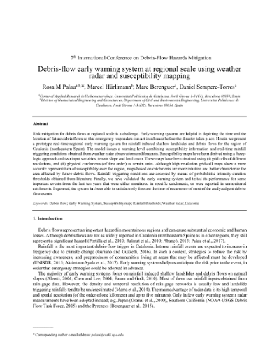
Debris-flow early warning system at regional scale using weather radar and susceptibility mapping
Risk mitigation for debris flows at regional scale is a challenge. Early warning systems are helpful in depicting the time and the location of future debris flows so that emergency responders can act in advance before the disaster takes place. Herein we present a prototype real-time regional early warning system for rainfall induced shallow landslides and debris flows for the region of Catalonia (northeastern Spain). The model issues a warning level combining susceptibility information and real-time rainfall triggering conditions obtained from weather radar observations and forecasts. Susceptibility maps have been derived using a fuzzy-logic approach and two input variables, terrain slope and land cover. These maps have been obtained using (i) grid cells of different resolutions, and (ii) physical catchments (of first order) as terrain units. Although high resolution grid-cell maps show a more accurate representation of susceptibility over the region, maps based on catchments are more intuitive and better characterize the area affected by future debris flows. Rainfall triggering conditions are assessed by means of probabilistic intensity-duration thresholds obtained from literature. Finally, we have validated the early warning system and tested its performance for some important events from the last ten years that were either monitored in specific catchments, or were reported in unmonitored catchments. In general, the system has been able to satisfactorily forecast the time of occurrence of most of the analyzed past debris-flow events.
026

Real-time monitoring of debris-flow velocity and mass deformation from field experiments with high sample rate lidar and video
Debris flows evolve in both time and space in complex ways, commonly starting as coherent failures but then quickly developing structures such as roll waves and surges. These processes are readily observed, but difficult to study or quantify because of the speed at which they occur. Many methods for studying debris flows consist of point measurements (e.g., of flow height or basal stresses), which are inherently limited in spatial coverage and fail to fully capture the spatiotemporal evolution of a flow. In this study, we use terrestrial lidar to measure debris-flow profiles at high sample rates to examine debris-flow movement with high temporal and spatial precision and accuracy. We acquired measurements during gate-release experiments at the USGS debris-flow flume, a unique experimental facility where debris flows can be simulated at a large scale. In this study, the laser scanner was placed at the bottom of the steep flume and recorded topography of the entire flume bed and debris flow at a rate of 60 Hz along a narrow profile (~1mm in width), providing a detailed, two-dimensional cross-section of the debris flow through time. The high- resolution profiles enabled us to quantify flow front and surge velocities of the debris flow and provide an unprecedented record of the development and evolution of the flow structure over time. The profiles also preserve a record of the highly variable deposition pattern of the debris flow on a downstream fan with a time resolution of hundredths of a second. In addition, video imagery from the experiment was used to track debris-flow movement through time. By acquiring high-resolution topographic data and video imagery during a controlled experiment, we have been able to obtain unusually complete quantitative measurements of debris-flow movement. Such measurements may help constrain future modeling efforts.
027
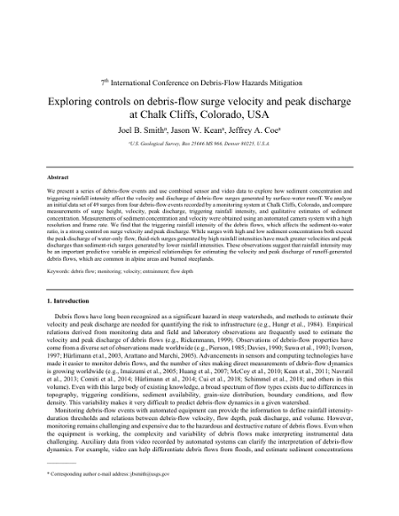
Exploring controls on debris-flow surge velocity and peak discharge at Chalk Cliffs, Colorado, USA
We present a series of debris-flow events and use combined sensor and video data to explore how sediment concentration and triggering rainfall intensity affect the velocity and discharge of debris-flow surges generated by surface-water runoff. We analyze an initial data set of 49 surges from four debris-flow events recorded by a monitoring system at Chalk Cliffs, Colorado, and compare measurements of surge height, velocity, peak discharge, triggering rainfall intensity, and qualitative estimates of sediment concentration. Measurements of sediment concentration and velocity were obtained using an automated camera system with a high resolution and frame rate. We find that the triggering rainfall intensity of the debris flows, which affects the sediment-to-water ratio, is a strong control on surge velocity and peak discharge. While surges with high and low sediment concentrations both exceed the peak discharge of water-only flow, fluid-rich surges generated by high rainfall intensities have much greater velocities and peak discharges than sediment-rich surges generated by lower rainfall intensities. These observations suggest that rainfall intensity may be an important predictive variable in empirical relationships for estimating the velocity and peak discharge of runoff-generated debris flows, which are common in alpine areas and burned steeplands.
028
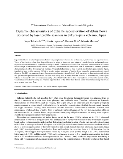
Dynamic characteristics of extreme superelevation of debris flows observed by laser profile scanners in Sakura-jima volcano, Japan
Supercritical flows in natural open channel show very complicated behavior due to shockwaves, roll waves, and superelevations. Traces of debris flows often show large difference in height at inner and outer sides of curved channels, and not only that, superelevation of debris flow is larger than that of pure water. This behavior of debris flow may cause underestimation of channel section design or unexpected bank erosion. Therefore, accumulation of observation data is important to estimate hydraulic characteristics of debris flows at curved channels. We conducted continuous field observations at Sakura-jima volcano, Japan, introducing laser profile scanners (LPSs) to acquire surface geometry of debris flows, especially superelevation at curved channels. The LPS can measure distance from sensor to obstacles with sufficiently high resolution to document superelevations and spillway flow profiles both in space and time on a survey line. A debris flow that occurred at Arimura River, Sakura–jima volcano on January 17, 2018 is well documented by LPSs. Data from the debris flow compared with coefficient in current model, which indicates traction/viscosity and potential superelevation of the debris–flow front is under-predicted assuming the flow is super-critical pure water flow.
029
Monitoring and early warning of debris-flow in an earthquake impacted area, Baishahe catchment, southwest China
After 10 years of the Wenchuan earthquake of China, the post-seismic landslides are turning weak. However, the debris flows in earthquake-stricken area continue to be threat. In order to reduce the risk from debris flows in this region, we discuss the operation of an alert system, monitoring objectives, and early-warning policies. Three gullies in the Baishahe catchment, Dujiangyan, Southwest China were selected and rain-gauge, tilt-sensor, mud-meter and ground acoustic meter combined to a warning system in April, 2014. The data collected from these events shows changes in susceptibility levels and triggering rainfall complicating the application of a fixed rainfall threshold for any alert system.
030
Deciphering debris-flow seismograms at Illgraben, Switzerland
Mass wasting, such as rockfalls, landslides and debris flows in steep mountain terrain, has a high destructive potential, and plays a key role in both erosion and landscape evolution. As an alternative to many conventional approaches, seismology allows monitoring of such mass movements at safe distances, provides estimates of event location and timing, and can give insights into dynamics and rheology granular flows. Here, we analyze seismic data recorded during the 2017 and 2018 debris-flow seasons at Illgraben, a steep canyon located in Switzerland. Yearly precipitation is controlled by summer rainstorms with high rainfall intensity during which mass wasting including rock-slope failure and debris flows occur regularly. The frequent debris-flow occurrence (on average three events per year) makes the Illgraben an ideal site for cross-validating a seismically-derived event catalog of mass movements with “ground-truth data”, such as digital terrain models, flow depths estimates and other in-torrent measurements. We present seismic frequency characteristics of the Illgraben debris-flow series and investigate how the seismic signature depends on actual debris-flow characteristics, such as grain sizes, and on propagation effects of the generated seismic waves. Whereas these two effects are usually difficult to separate, the source component contains valuable information on the flow’s material composition. Stations that are close to the torrent, we find that dominant frequencies in the recorded signal reflect the distance to the dominant source. For one particular station, this is shown on recordings of several events, where a dominant frequency of about 5.5 Hz indicates the passing of the flow at a 48m check dam. Power spectral densities at that instance give an estimate of the particle content of the debris flow. We also find that a jump in dominant frequency does not necessarily reflect the location of the flow front. Seismic studies of debris-flow dynamics and material composition should therefore not be limited to entire debris-flow seismograms, but instead focus on individual time windows and consider different sensors separately. The presented analysis underlines the use of seismic data in torrent and landscape studies.
031
Reproducibility of debris-flow fan physical modeling experiments
Debris-flow fans are common in steep mountainous terrain. The complexity of these environments makes it difficult to be onsite at the time of the debris flow, which has led many researchers to turn to physical models. While physical models have played an integral role in unraveling how alluvial fans have been developed, little work has been done to test and validate the approaches and results reported in physical models. Here, we replicated a debris-flow physical model developed at Utrecht University in a laboratory at East Carolina University (ECU). The ECU physical modeling experiment was done in an independent laboratory from the original study and was conducted with different equipment and different operators. Sediment size and water volume varied slightly from the original experiments. Fifty-six debris flows were released to form the ECU fan. Each debris flow was recorded with video. Terrestrial laser scanning recorded the topographic changes on the ECU fan throughout the experiment. Despite sediment size and water volume differences, ECU’s physical model replicated the autogenic processes promoting flow avulsion patterns in a debris-flow fan with simulated unlimited accommodation space (the trap door in feeder channel and table edge did confine the maximum extent the fan could grow). These results corroborate previous findings from the Utrecht fan and support the repeatability of processes from the different models despite differences in the materials used as the debris-flow medium. Reproducibility also permits future collaborative efforts to run multiple concurrent physical modeling experiments to increase the sample size of the study populations on debris-flow processes and resulting forms.
032
Influence of momentum correction factor and friction factor on flow models of debris-flow related to flow surface deformation
Intermittent debris-flow surges may be considered as roll wave phenomenon of shallow water flow that naturally develop in the mountain basins. The shape of the water surface with discontinuous depth change is one manifestation of flow wave phenomena. Here we obtained a wave equation representing the wave phenomenon of shallow water flow by using the Laplace equation, the bottom condition, a surface conservation condition, a flow surface fluctuation condition, and the perturbative expansion method. The derived equation is a kind of KdV-Burgers equation in which a nonlinear term includes a momentum correction factor b, a dissipation term includes a friction factor f’ and a third term does not include either dispersion terms. The derived equation offers an explanation of the discontinuity of the water surface in shallow water flow that may be useful for debris flow modeling.
033
Constraining parameter uncertainty in modeling debris-flow initiation during the September 2013 Colorado Front Range storm
The occurrence of debris flows during the September 2013 northern Colorado floods took the emergency management community by surprise. The September 2013 debris flows in the Colorado Front Range initiated from shallow landslides in colluvium. Most occurred on south- and east-facing slopes on the walls of steep canyons in crystalline rocks and on sedimentary hogbacks. Previous studies showed that most debris flows occurred in areas of high storm-total rainfall and that strength added by tree roots accounts for the low number of landslides in densely forested areas. Given the lack of rainfall thresholds for debris flow occurrence in northern Colorado, we want to parameterize a numerical model to assess potential for debris flows in advance of heavy rainfall. Natural Resources Conservation Service (NRCS) soil mapping of the area, supplemented by laboratory testing and field measurements, indicates that soil textures and hydraulic properties of landslide source materials vary considerably over the study area. As a step toward modeling storm response, available soil and geologic mapping have been interpreted to define zones of relatively homogeneous properties. A new, simplified modeling approach for evaluating model input parameters in the context of slope and depth of observed debris flow source areas and recorded debris-flow inducing rainfall helps narrow the range of possible parameters to those most likely to produce model results consistent with observed debris flow initiation. Initial results have narrowed the strength parameters to about one third of possible combinations of cohesion and internal friction angle and narrowed hydraulic conductivity to a range spanning slightly more than one order of magnitude.
034

Evaluation of debris-flow runout model accuracy and complexity in Montecito, California, An: towards a framework for regional inundation-hazard forecasting
Numerous debris-flow inundation models have been applied retroactively to noteworthy events around the world. While such studies can be useful in identifying controlling factors, calibrating model parameters, and assessing future hazards in specific study areas, model parameters tailored to individual events can be difficult to apply regionally. The advancement of debris-flow modeling applications from post-event model validation of individual case studies to pre-event forecasting that can be implemented rapidly and at regional scales is critical considering the fatalities and extensive infrastructure damage caused by debris flows that inundated a developed fan in Montecito, California, following heavy rain on 9 January 2018. In this study, we evaluated the tradeoffs between model accuracy and simplicity in the context of the need for a framework that can be used in conjunction with initiation models and storm predictions for rapid, large-scale inundation hazard mapping as a component of post-fire debris-flow hazard assessments. We used numerical (FLO-2D) and empirical (LAHARZ) models to simulate debris flows from one of the drainages upstream of Montecito that was burned in the Thomas fire in December 2017 and compared model results with field observations and building damage assessments collected immediately following the event. Initial testing demonstrated that LAHARZ can simulate channelized flow but is not able to replicate flow bifurcations or avulsions, which are critical aspects of flows travelling over populated fans. FLO-2D simulations matched well with observed inundation area data, but variably under- and overpredicted inundation height, deposit depth, and velocity. We found that FLO-2D and LAHARZ had true positive rates of 0.84 and 0.6, respectively, and both models had similar false positive rates (0.3 and 0.35, respectively). Our model evaluation framework allowed us to compare model results with detailed field observations and will serve as a platform for more extensive model testing in the future.
035
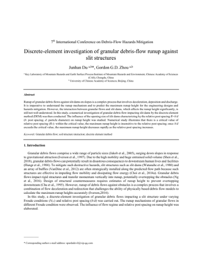
Discrete-element investigation of granular debris-flow runup against slit structures
Runup of granular debris flows against slit dams on slopes is a complex process that involves deceleration, deposition and discharge. It is imperative to understand the runup mechanism and to predict the maximum runup height for the engineering designs and hazards mitigation. However, the interaction between granular flows and slit dams, which affects the runup height significantly, is still not well understood. In this study, a numerical investigation of granular debris flow impacting slit dams by the discrete element method (DEM) was then conducted. The influence of the opening size of slit dams characterizing by the relative post spacing R=b/d (b: post spacing; d: particle diameter) on runup height was studied. Numerical study illustrates that there is a critical value of relative post spacing (RC): within the critical value, the maximum runup height is insensitive to the relative post spacing; once b/d exceeds the critical value, the maximum runup height decreases rapidly as the relative post spacing increases.
036
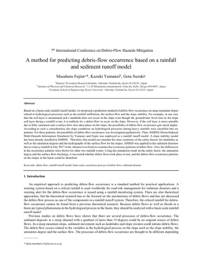
Method for predicting debris-flow occurrence based on a rainfall and sediment runoff model, A
Based on a basin scale rainfall runoff model, we proposed a prediction method of debris-flow occurrence on steep mountain slopes related to hydrological processes such as the rainfall infiltration, the surface flow and the slope stability. For example, in one case that the soil layer is unsaturated and a landslide does not occur in the slope even though the groundwater level rises in the slope soil layer during a rainfall event, it is unlikely for a debris flow to occur on the slope. However, if the soil layer is more unstable due to fully saturation and a surface flow also takes place on the slope, the possibility of debris-flow occurrence gets much higher. According to such a consideration, the slope conditions on hydrological processes during heavy rainfalls were classified into six patterns. For these patterns, the possibility of debris-flow occurrence was investigated qualitatively. Then, SiMHiS (Storm Induced Multi-Hazards Information Simulator) by Yamanoi and Fujita was employed as a rainfall runoff model. A slope stability model has been already installed in SiMHiS. Therefore, this model can simulate the time variations of the safety factors for landslides as well as the saturation degrees and the hydrographs of the surface flow for the slopes. SiMHiS was applied to the sediment disasters due to a heavy rainfall in July 2017 in the Akatani river basin to examine the occurrence patterns of debris flow. Also, the differences in the occurrence patterns were shown for other two rainfall events. Using the simulation result on the safety factor, the saturation degree and the surface flow discharge, it was noted whether debris flows took place or not, and the debris-flow occurrence patterns on the slopes in the basin could be identified.
037
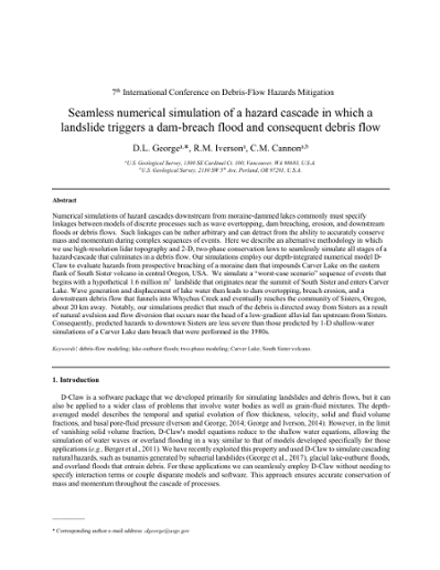
Seamless numerical simulation of a hazard cascade in which a landslide triggers a dam-breach flood and consequent debris flow
Numerical simulations of hazard cascades downstream from moraine-dammed lakes commonly must specify linkages between models of discrete processes such as wave overtopping, dam breaching, erosion, and downstream floods or debris flows. Such linkages can be rather arbitrary and can detract from the ability to accurately conserve mass and momentum during complex sequences of events. Here we describe an alternative methodology in which we use high-resolution lidar topography and 2-D, two-phase conservation laws to seamlessly simulate all stages of a hazard-cascade that culminates in a debris flow. Our simulations employ our depth-integrated numerical model D- Claw to evaluate hazards from prospective breaching of a moraine dam that impounds Carver Lake on the eastern flank of South Sister volcano in central Oregon, USA. We simulate a “worst-case scenario” sequence of events that begins with a hypothetical 1.6 million m3 landslide that originates near the summit of South Sister and enters Carver Lake. Wave generation and displacement of lake water then leads to dam overtopping, breach erosion, and a downstream debris flow that funnels into Whychus Creek and eventually reaches the community of Sisters, Oregon, about 20 km away. Notably, our simulations predict that much of the debris is directed away from Sisters as a result of natural avulsion and flow diversion that occurs near the head of a low-gradient alluvial fan upstream from Sisters. Consequently, predicted hazards to downtown Sisters are less severe than those predicted by 1-D shallow-water simulations of a Carver Lake dam breach that were performed in the 1980s.
038

Woody debris blocking conditions at bridges in mountainous streams
When debris flows occur, bridges in mountainous streams may become dangerous when blocked by woody debris. When bridges are blocked with accumulated woody debris, high flow depths can cause the flow to spread widely. However, not all bridges become blocked with woody debris. Many studies have examined bridges blocked with woody debris for gentle slopes, but few studies have been conducted on steep mountain streams with supercritical flow. To better understand the interaction of woody debris and bridges across steep streams, we conducted laboratory experiments using one-pier bridge model and considered factors for the blockage of bridges by woody debris. We used straight rectangular channel flume 7 m in length, 0.3 m width, and with a variable slope. We supplied steady water from upstream end. We supplied woody debris model to the upstream end of the flume at approx.1 second. We set the bridge model 1.5 m upstream from the downstream end of the flume. We used ABS plastic material with a specific weight of 1.05 for the experimental woody debris. We varied the flume slope, water discharge, supply of woody debris, length of wood, height of bridge piers and Froude number. When the woody debris reached the bridge model, the total time of woody debris to pass through became longer from the supplied upstream condition due to rotational motion and diffusion. Because the total time changed, the amount of woody debris per unit time at the bridge was smaller than supplied condition. When examining the blocking conditions, we applied the woody debris condition at bridge model. From the results, we proposed methods to estimate the threshold condition of woody debris blocking at bridge from dimensional analysis. We applied parameters combining the experimental conditions of the bridge model, woody debris model, and hydraulic conditions, as well as the amount of woody debris per unit time required for bridge blocking.
039
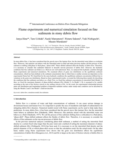
Flume experiments and numerical simulation focused on fine sediments in stony debris flow
In stony debris flow, it has been considered that the gravels move like laminar flow, but the interstitial water behave as turbulent flow. Moreover, fine particles can behave with the interstitial water as fluid and many previous studies call this process of fine sediment as shifting solid phase to fluid phase, “phase-shift”. Phase-shifted sediment affect the fluidity of debris flow. Therefore, it is necessary to consider fine sediments behavior to describe run-out processes of debris flow. However, the hydraulic conditions that fine sediment can behave as a fluid are not well understood. Here, we analyzed this hydraulic condition through flume experiments and numerical simulations. We examined effects of grain size distribution on the equilibrium sediment concentration, which has been defined as the sediment concentration that in which there is neither erosion nor deposition on the experimental flume bed. We found that for the same hydraulic conditions the equilibrium sediment concentration differed due to variations in the grain size distribution. Based on these experimental results, we tested the following three models for describing the conditions that fine sediment can behave as a fluid. First, we fixed fine sediment concentration in interstitial fluid (Model 1), then, we fixed the maximum diameter of phase-shifted sediment (Dc) (Model 2). In Model 3, Dc is assumed to be variable according to the ratio of the friction velocity to the settling velocity of Dc. As the result, the experimental relationship between grain size distribution and longitudinal gradient of deposited sediment surface under steady-state condition can be described by using the Models 2 and 3, but Model 1 could not describe.
040
On the regression of velocity distribution of debris flows using machine learning techniques
Five machine learning techniques– classical nonlinear regression (NLR), multi-layer perceptrons (MLP), support vector machines (SVM) with radial-basis function (RBF) kernel, k nearest neighbour (kNN) and decision tree (DT) schemes– were applied for regression of velocity distribution along the depth of debris flows by using experimental data of steady uniform open-channel flows. Programs coded in Python and package scikit-learn were developed for machine learning analyses. Experimental results of two cases conducted and published by Matsumura and Mizuyama (1990) were adopted for training and prediction curves of the velocity distributions using the five different machine learning techniques. Three theoretical formulas were employed for comparison and investigation, the power-law derived by Takahashi (1978) based on Bagnold dilatant flow, theory modified by Matsumura and Mizuyama (1990), and the two-region formula derived by Su et al. (1993). R-squared scores for each case were calculated to check the fitness of the machine learning results to the experimental data and then to verify the fitness of the theoretical formulas to the machine learning predictions. The quantified results revealed that machine learning schemes provide powerful approaches for building prediction models for velocity distribution of debris flows.
041

Experimental evaluation for peak and temporal changes in debris-flow initiation processes
Saturated sediment water mixture flow can move as landslide if the vertical sediment concentration is constant and the value takes a maximum sediment concentration, c*, which is sediment concentration in the non-flowing layer in sediment deposition. The flow is debris flow over the rigid bed and the flow can change as debris flow with vertical sediment concentration distribution if the saturated flow reaches downstream reach, where bed inclination is around 17 to 18 degrees. The thinking proposes that it is important to know transition process in between saturated landslide and debris flows in evaluating peak and temporal changes of debris flows in initiation processes for debris-flow mitigation in planning and design of sabo dam, because the transition process can be explained by a relation between bed slope and depth-averaged sediment concentration (e.g., Takahashi 1991). In present study, important knowledge for estimating peak discharge is discussed using experimental data obtained by present flume tests. Flume tests are carried out using prismatic open channel which is set 22 degrees and around 18 degrees at downstream end. Sediment is deposited parallelly to the flume bed and water is supplied steady at upstream end, and the transition of between saturated landslide to debris flow is produced. Two kinds of sediment deposition depth and length are specified in the present tests, and temporal changes of debris flow are measured using side view of digital video camera and debris-flow runoff at downstream end of the flume. The data shows that peak discharge rate of debris flow depends on sediment volume during debris-flow running from the up to the downstream reach, and that entrained sediment volume by a debris flow will be determined by erosion capacity during a debris-flow surge.
042
Correlation between the slump parameters and rheological parameters of debris-flow
Rheological characteristics are important information for understanding or simulating debris-flow movement. Debris-flow movements involves complex and heterogeneous material with grain size distributions ranging from silt to large rocks. Conventional rheometers are usually limited to measure the rheological parameters of debris-flow of fine particles. Slump-tests has been used to evaluate the flow behaviour of fresh concretes which allow the tested concrete slurries to have larger particles. In this study, the relationship between the parameters obtained from rheometer measurements and slump tests for debris-flow slurries with/without big particles were investigated. At the initial stage, we used fine-sediment slurries to conduct rheological experiments to find the relationship between the parameters obtained from the rheometer measurements and slump tests. The rheological parameters of slurries were measured using the ‘Brookfield DV-III rheometer’. The rheological behavior of the slurry samples used in this study follow the Bingham fluid model. Rheological parameters (i.e., yield stress and viscosity) are affected by the concentration of slurry, indicating that the higher the concentration, the greater the value of the rheological parameters. Slump test was then conducted using the same material samples prepared for rheometer test and the slumped height and spreading diameter of the tested sample were measured. The result shows that the slump height ratio and spreading ratio of the tested slurry decrease with the increase of slurry sediment concentration. Experimental sediment slurry samples were prepared by mixing coarse sands of about 1 mm in diameter. Our results show that the parameters obtained by rheometer measurements are closely related with those by slump tests for the slurries used in this study, indicating that there is a high potential to evaluate rheological parameters of debris-flow using a slump test as an alternative method.
043
Concentration distribution in debris flow consisting of particles with two different sizes
Debris flows contain solid particles of various sizes. The gaps between large particles contain fine-grained sediment, and this is known to maintain high pore pressures. Inverse grading in which large particles become increasingly concentrated towards the surface of the flow is also known to occur. Therefore, to determine the flow behavior, it is important to clarify the grain-size distribution for not only large particles, but also fine sediment in the depth direction of the flow. In the present study, we generated a debris flow by eroding riverbed material consisting of large particles and fine-grained sediment in an experimental flume, and measured the concentration of different sized particles in layers at three different depths. The test results showed that the highest concentration of large particles was in the middle layer. The highest concentration of fine-grained sediment was in the bottom layer, and this concentration decreased towards the surface of the flow. Inverse grading was observed from the bottom layer to the middle layer; however, no noticeable inverse grading occurred from the middle layer to the upper layer. The reason for this kind of concentration distribution is considered to be that there was insufficient turbulence in the gaps between large particles in the bottom layer, and so fine-grained sediment settled, while in the upper layer, interstitial turbulent stress developed and fine-grained sediment was dispersed. We calculated the concentration distribution of fine-grained sediment from the middle to the upper layer on this basis, and the results were in general agreement with the measured distribution in the dispersion region.
044

Debris-flow hazard investigation with Kanako-2D in a rural basin, Alto Feliz municipality (Brazil)
Mountainous regions of Brazil, especially where rural families live, need to be assessed for debris flow. Though debris flows rarely occur in this country, they have caused serious damages including human losses. Computational modeling of debris flows is an important tool to develop hazard maps and to improve the understanding of debris-flow mechanisms, since observed occurrences are rare. Therefore, the objective of the present study was to evaluate the potential for debris flows in a small rural basin (0.712 km²), in the municipality of Alto Feliz, Rio Grande do Sul state (Brazil), by using the Kanako-2D model which was calibrated with another debris flow in the same region. We simulated three scenarios by altering the debris volume and consequently the hydrograph (peak flow and peak time). All the scenarios show that debris flows would impact an existing rural house, even with the smallest potential debris volume. The modeled erosion and deposition areas along the debris flow are similar, with the magnitudes (depths) of erosion and deposition being different among the scenarios. In general, in each transversal section, the most pronounced point of erosion or deposition is almost always at the thalweg location. Along the stream channel, deposition was greatest upstream of an abrupt reduction in slope. The formation of a natural dam is observed at the channel junctions where erosion and deposition alternatively took place. Because of the investigation of the potential of debris flows, the simulation results were not compared with the actual occurrence in the present study. However, the present study could show that computational modeling of debris flow is very important for localities where debris flow occurs and that the debris-flow hazard map is useful for land-use planning.
045
Numerical analysis on the behavior of the debris flows and impact force on check dams
Debris flows with high velocity may have enormous impact forces on obstacles in their flow paths. It is necessary to install protective structures, such as check dams that slow down or interrupt the debris flows from affecting adjacent infrastructure and residential communities. The impact forces of debris flows on check dams are an essential factor in hazard mitigation evaluation and design of check dams. To accurately evaluate the impact force of debris flows on the check dams, a numerical model that takes into account the fluid-solid interactions is needed. In this study, the large deformation analysis, which is the coupled Eulerian- Lagrangian (CEL) technique, was applied to evaluate the behavior of the debris flows and the impact force on the check dams, simultaneously. The numerical method was validated using published data on laboratory experiments. A series of numerical analyses were performed to evaluate the significant influencing factor on the dynamic impact force of debris flows, such as the flow velocity and the thickness of sedimentation. Based on the results of these analyses, it was observed that the dynamic impact force of debris flows on the check dams is significantly dependent on the velocity of the debris flows. In addition, the debris flows are gradually accumulated towards the top of the check dams after the debris flows first contacts the check dams, thereby the position of the dynamic load acting on the check dams is increased.
046
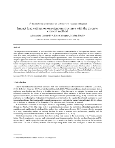
Impact load estimation on retention structures with the discrete element method
The design of countermeasures such as barriers and filter dams needs an accurate estimation of the impact load. However, debris flows typically contain poorly sorted grains, whose size can span several orders of magnitude. Large grains can induce impulsive loads on a barrier, and potentially clog the openings designed to induce self-cleaning after an event. The current modeling techniques, mostly based on continuum-based depth-integrated approximations, cannot accurately describe these mechanisms, and analytical approaches often fail to tackle this complexity. In an effort to reproduce a realistic impact load, a sample flow composed of grains is reproduced with a three-dimensional model based on the Discrete Element Method (DEM). The mass impinges upon a barrier with a prescribed velocity. The barrier design is inspired by a monitored dam built on a catchment located in the Italian Alps, which features multiple outlets. The grains can clog the outlets, forming frictional arches. The load pattern on the barrier is analyzed in terms of single-grain impact and of collective behaviors. The impulse transferred by the granular mass to the structure is then used as input for a structural analysis of the barrier through a Finite Element analysis. The results highlight how frictional chains can induce loads that are substantially different from those determined by standard analytical approaches.
047
Debris-flow deposition: effects of fluid viscosity and grain size
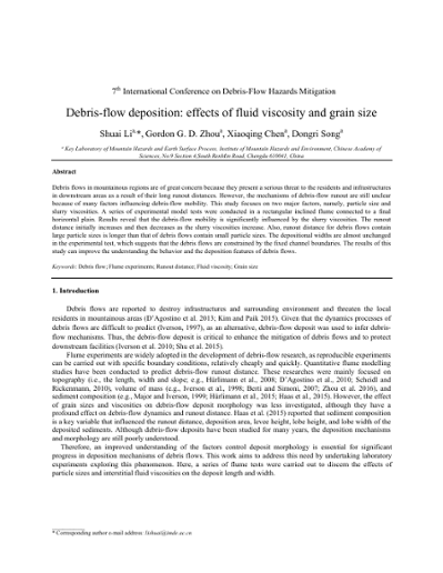
Debris flows in mountainous regions are of great concern because they present a serious threat to the residents and infrastructures in downstream areas as a result of their long runout distances. However, the mechanisms of debris-flow runout are still unclear because of many factors influencing debris-flow mobility. This study focuses on two major factors, namely, particle size and slurry viscosities. A series of experimental model tests were conducted in a rectangular inclined flume connected to a final horizontal plain. Results reveal that the debris-flow mobility is significantly influenced by the slurry viscosities. The runout distance initially increases and then decreases as the slurry viscosities increase. Also, runout distance for debris flows contain large particle sizes is longer than that of debris flows contain small particle sizes. The depositional widths are almost unchanged in the experimental test, which suggests that the debris flows are constrained by the fixed channel boundaries. The results of this study can improve the understanding the behavior and the deposition features of debris flows.
048
Regional-scale modelling of liquefaction-induced shallow landslides in unsaturated slopes
Regional modelling of rainfall-induced landslide triggering poses several technical challenges. These events can originate from a number of hydro-mechanical processes, such as soil-strength degradation, development of localized zones of pore-water pressures, liquefaction, among others. At the same time, the interplay between the spatial variability of topographic attributes, soil properties and transient infiltration can lead to a widespread distribution of distinct slope failure mechanisms across the same landscape. To this aim, this contribution describes a simulation platform for the efficient generation of storm-induced, landslide susceptibility maps in which different slope instability mechanisms can be considered. The framework relies on a vectorized finite element (FE) algorithm that performs fully-coupled simulations of transient infiltration in unsaturated soils, while input and output processing stages are linked to a Geographical Information System. To illustrate the capabilities of the proposed framework, the role of several hydro-mechanical processes on the inception of slope instability are first explored (i.e., coupled flow-deformation analyses, constitutive couplings). After this, results of regional-scale simulations are presented, where it is shown that such considerations can affect the computed spatio-temporal patterns of landslide triggering. Lastly, approaches to incorporate uncertainty of input data into landslide susceptibility zonation by using spatially-correlated random fields are discussed. The proposed framework provides an important step towards the development of robust, physically-based models for regional landslide hazard assessment.
049
Flume experiment on the influence of particle size distribution on sediment capturing efficiency of open-type steel Sabo dams
The purpose of this study is to clarify the influence of particle size distribution on the sediment capturing effect of open-type steel Sabo dams constructed in the sediment sheet flow section. First, we conducted a flume experiment in order to clarify the minimum boulder size contributing to blockage (flume gradient was 5 °). Based on the result, we set the particle size distribution for a flume experiment to clarify the effect of particle size distribution on the sediment capturing effect of the open-type steel Sabo dams in the sediment sheet flow section. We found that the minimum boulder size contributing to blockage is 1/3 to 1/2 of the individual grid width. We tested the volumetric effects of sediment larger than the minimum boulder size on sediment capturing efficiency through its contribution to blockage. In addition, we defined the value obtained by dividing the blockage-contributing sediment volume per unit area by the average particle size as “dimensionless sediment volume contributing to blockage”. We found that this “dimensionless sediment volume contributing to blockage” and sediment capture rate have a logarithmic approximation relationship. Thus, this value can be expected as a new index for setting the individual grid width of the open-type steel Sabo dams.
050
Debris-flow behavior containing fine sediment considering phase shift
Recent observations have shown that debris flows containing fine particles in volcanic regions exhibit greater mobility compared to stony debris flows. Recent researches have described that greater mobility occurred from fine sediment phase shift from solid phase to fluid phase in debris flow. In Japan, debris-flow research and sabo or erosion control planning widely apply the equilibrium concentration methods proposed by Takahashi. For considering fine sediment phase shift with the equilibrium method, it is proposed to set high fluid density. However, the mechanism of phase shift and behaviours of debris flows with fine sediment, are not fully understood. In this study, we conducted hydraulic experiments with sediment particles of two different diameters, defined as fine sediment and coarse sediment. We applied the equilibrium methods and took into account the increased fluid phase density due to the sediment phase shift to fluid. From the results, we found that part of the fine particles contribute to the increase in the fluid phase density. When conducting experiments, not only fine sediment, but some parts of coarse sediment behaved as a fluid. For considering the shift of sediment to fluid phase in debris flows, we presumed that the flow turbulence in debris flow affected. Regarding the sediment concentration, higher total sediment (coarse and fine) concentration increased the fluid phase density. A larger ratio of coarse sediment increased the fluid phase density more than when sediment contained only fine particles. It was speculated to occur from the flow turbulence owing to the mixture condition. Cases with smaller total sediment discharge showed higher fluid phase density though in same sediment concentration. We also found that the larger dimensionless tractive force showed a smaller ratio behaving as fluid phase, which was in contrast with the trends in recent studies.
051
Effect of rheological properties on debris-flow intensity and deposition in large scale flume experiment
Debris flows are one of the most serious hazards in the mountainous areas. To assess and mitigate the debris-flow hazard, debris- flow intensities and deposition on fans must be estimated. Rheological properties including yield stress and viscosity are major parameters to describe and predict behaviors of debris flow. In the present study, the effect of rheological properties on debris-flow intensities and deposition on fans of natural clay was investigated using large scale flume experiments. The experimental device employed in the tests consists of a tilting flume with an inclination 17°, on which a steel tank with a removable gate was installed. A final horizontal plane works as the deposition area. Natural soil samples of different water contents were tested. Rheological properties of soil mixtures were obtained from vane-rheometer tests. Non-linear regression analysis was used to assess the effect of yield stress and viscosity on debris-flow velocity, runout distance, deposited area and deposited volume. We found that the relationship between surface velocity profile and horizontal distance was complicated and could be expressed by sixth order polynomial function. Mean velocity, runout distance, deposited area decreased following a power law with an increase in yield stress and viscosity. Empirical equations were proposed to estimate these properties. The results of laboratory tests compared reasonably well with the results from numerical analysis. The results indicated that yield stress and viscosity play a significant role in the behavior of debris flow.
052
Long travel distance of landslide-induced debris flows
Large-scale landslides often induce debris flows and cause serious damage to humans. These events typically have water contents in the landslide mass less than 60% and sediment concentrations more than 40%. In spite of high sediment concentrations, landslide-induced debris flows can runout long distances. For large-scale stony debris flows, many previous studies have suggested that coarse gravels behave as a solid phase, whereas fine particles with interstitial water can behave as a fluid phase. We hypothesized this fine sediment might be one of the key processes controlling the long travel distances of landslide-induced debris flows. Here we assumed that the maximum diameter of the fine sediment behave as a fluid phase should vary depending on the friction velocity of the debris flow and the settling velocity of sediments. We conducted detailed field surveys for four landslide-induced debris flows and applied our numerical simulation model to describe the travel distance of the debris flows. Our results show that, if we set the ratio of the friction velocity of debris flow to the settling velocity of sediments around 1 to 4, the simulated travel distance agreed well with our studied four debris flows. We also confirmed that, while the total volume or mean sediment diameter of debris flows varied between study cases, the variability of ratios was small. We believe that our new method and the information it provides, may be helpful for predicting the future risk from the landslide-induced debris flows.
053
Submerged planar granular column collapse: fluid fluxes at the collapsing granular front
Understanding of particle-fluid interactions in a kinematic system is of great importance in the assessment and mitigation of natural mass flows (i.e., debris flows, submarine landslides, pyroclastic density currents). Previous research has pointed on the crucial role of the solid packing fraction in the motion of saturated and submerged granular systems. However, issues in understanding the role and dominance of particle-fluid interactions in transitional granular flows remain a work in progress. The granular column collapse allows a simplification of the complex dynamics observed in those systems, in which a granular assembly is organized with a given aspect ratio, between its initial height and initial width (a=H0/R0), and let to collapse by self-weight onto a horizontal surface. This work presents a new approach to study submerged granular columns through the use of a modified planar model, incorporating a novel gate mechanism that does not interact with the surrounding fluid nor the granular media. Dye fluid is added to visualize the behaviour of the fluid enclosing the granular mass. Experimental results allow the formulation of an interaction mechanism between the particles and the surrounding fluid, identifying the fluid inflow into the column at release, followed by an recirculating outflow during the column spreading. These fluxes between the mobile mass and the fluid result in vortices next to the surface, entraining particles and mixing the surrounding fluids. The insights and conclusions gained in this research can be applied to the development and validation of analytical and numerical models studying the motion of immersed granular flows.
054
Small scale debris-flow experiments on run-up height
We studied the run-up behavior of debris flows in a small-scale experimental flume using various material compositions, approach flow velocities, and geometries of the obstacle. The experiments were performed with a straight and 4 m to 6 m long flume channel with a circular cross-section of 15 cm top width. The debris flows were released from a head tank. We used three debris-flow mixtures, three channel slopes and either a vertical wall or an adverse slope of 30° as an obstacle. Additional tests were performed using water without sediment. The inclined channel was followed by a 30 cm long horizontal transition reach. Immediately upstream and along this reach we measured the shape of the approaching debris-flow surge with four laser sensors, and determined also the approach flow velocity and depth. The run-up conditions were recorded with a high-speed video camera. The measured run-up conditions were compared with four different theoretical models. The observed run-up conditions differed to some extent between debris-flow mixtures and clear water flows, and there were also some differenced among the debris flow mixtures depending on the relative proportion of coarse particles. The observed run-up heights were generally within the range predicted by the theoretical models, but none of them appears to be universally applicable to the entire range of investigated flow conditions. The commonly used energy principle is not always a conservative method to estimate run-up heights, as has been reported in previous studies.
055
Numerical simulation of debris flows focusing on the behavior of fine sediment
Debris flows generally includes a wide range of grain sizes, in which fine sediment behaves as a fluid phase rather than as a solid phase and enlarges the pore fluid density. Although in existing models fine sediment constantly behave as fluid phase from initiation to deposition, previous researches have reported that behavior of fine sediment can vary through debris-flow propagations depending on the kinematic conditions (i.e., relation of turbulence and the settling velocity of the particles). To test the effects of this transitional behavior of fine sediment and compare with existing models, we conduct numerical simulations of debris flows with bidisperse granular materials, employing two models for the behavior of small particles: (i) all small particles constantly behave as a fluid phase (Model I); and (ii) the ratio of small particles behaving as a fluid phase varies depending on the kinematic conditions (Model II). In the simulations, we used an inclined channel with erodible bed at the upper stream end of the reach, where debris flows initiate by supplying water. Varying the inclination from 15° to 20°, we measured the time series of discharges, flow depths, sediment concentrations and pore fluid densities at the downstream end. Hydrographs of the two models are significantly different at higher slopes, with a sharp peak at the front of debris flows in Model I and relatively moderate peak in Model II. These differences are caused by higher pore fluid densities from the front to the tail of debris flows in Model I, in contrast to lower pore fluid densities in Model II, where not all of small particles behave as a fluid phase. This infers that discharge rate of debris flows can be overestimated especially at higher slopes if the transitional behavior of fine sediment is not considered.
056
Possibilities and limitations for the back analysis of an event in mountain areas on the coast of São Paulo State, Brazil using RAMMS numerical simulation
Debris flows are mass movements that develop along drainage networks and involve generally dense fluids, compose of materials of different grain sizes, as well as woods and variable amounts of water, identified as natural processes that constitute the dynamics and the modeling of the landscape. The areas most susceptible to the occurrence of these processes in Brazil are in the foothills of the Serra do Mar, Serra da Mantiqueira and the Serra Geral, and on the north coast of São Paulo State. In 03/18/1967 there was an important landslide and debris-flows which affected the region of Caraguatatuba and São Sebastião. In this area, there is a pipeline network associated with Petrobras Treatment Units, other enterprises, structures and a large urban area in growth. The aim of this work is to show the results of the back-analysis of the debris-flow events that occurred in 1967 in a mountain area in the Serra do Mar in Caraguatatuba region (São Paulo State, Brazil) with RAMMS numerical simulation, using calibrated input parameters. The inputs were viscosity, DEM, landslide scars as release areas, the density of the debris-flow material, duration of debris-flow process and orthophoto. The modeling results were compared with the deposit area mapped in aerials photos, which was established zones of iso-thickness of the materials. The results showed a good correlation between the area and thickness of deposition modeled and observed. Moreover, the fieldwork and the retro-analysis studies revealed that the Serra do Mar debris flows have a predominantly granular rheological flow and the modeling results showed that the deposition zones are given preferably in regions with slope less than 5º.
057
Optical measurements of velocity and of solid volume fraction in fast dry granular flows in a rectangular chute
Geophysical flows, like avalanches and debris flows, are characterized by the gravity-driven motion of a granular medium immersed in an interstitial fluid. To better understand their dynamics, laboratory investigations represent invaluable tools and are essential to study several peculiar features (e.g. the effects of fixed boundaries, non-local momentum exchanges, segregation effects) that are difficult to isolate at the field scale. An experimental study on dry granular flows in a chute geometry is reported. Different basal conditions are investigated by varying the bed roughness. Several flow rates are investigated by adjusting the inflow boundary condition. By employing two high-speed cameras and particle image velocimetry (PIV) technique, accurate velocity measurements (typical error ≈0.004 m/s) could be obtained at sidewall and free surface. An innovative stochastic-optical method [Sarno et al., Granul. Matter, 2016], which exploits highly controlled illumination conditions guaranteed by a flickering- free planar lamp, allowed to obtain reliable volume fraction profiles (typical error ≈0.025). The method uses a transfer function, numerically determined on random grain distributions of known volume fraction. This function stochastically relates the near- wall volume fraction with a measurable quantity, named two-dimensional volume fraction and accessible by binarization of digital pictures, taken by a high-speed camera. The combined knowledge of velocity and volume fraction fields allowed a detailed description of the rheological behavior of channelized granular flows and of the effects of the flume boundaries. The superposition of different flow regimes is revealed by different shapes of velocity and volume fraction profiles along the flow depth. It emerges that frictional momentum exchanges increase at the expense of collisional mechanisms with increasing depth. This behavior appears related to the sidewall resistances and to the increasing normal pressures.
058
Debris flow behavior in super- and subcritical conditions
Observations of debris-flow events all over the world cover a wide range of phenomenologically similar processes, consisting of different concentrations of water, fine and coarse sediment, and frequently wooden debris. For this reasons, empirically derived coefficients to be used in prediction models to estimate debris-flow dynamics often show a wide degree of scatter. Two of such empirically derived concepts, originally developed for pure water flows, are presented in this study, showing similar deviations from hydrostatic stress assumption in subcritical flow conditions. The first concept is used to estimate debris-flow velocities, based on superelevation data. Based on our experimental results as well as observations from real debris-flow events at the field monitoring station at Illgraben (canton Valais, Switzerland) we show that the empirical coefficient used in the superelevation equation to account for non-Newtonian flow effects correlates with the Froude number – the dimensionless ratio between gravitational and inertia forces in the flow. Interestingly, a similar relationship – the second concept presented – has been found in recent studies to estimate the maximum impact pressure of a debris-flow event. Our results suggest that for debris flows and decreasing Froude numbers inertia forces become more important and the hydrostatic pressure distribution may be an unrealistic assumption for empirically based prediction models in subcritical conditions.
059
Experimental examination for influence of debris-flow hydrograph on development processes of debris-flow fan
In order to assess the influence of different flow hydrographs on fan development processes, we carried out flume tests using a sloped channel (15°, 10 cm wide) with a deposition area (slope decreases from 12° to 3° at a rate of 3° per m). The channel was filled with 0.12 m3 of sediment materials. Debris flows were generated by the entrainment of filled sediment via a steady water flow (0.003 m3/s). We used two types of water supply systems: single surge (60 second duration) and double surge (first surge lasting 50 seconds followed by a second surge with 45 second duration). For the double surge system, there was a 60 second pause in water supply between two surges. Fan formation processes in the deposition area were captured on video, and synchronized interval photography (1 second intervals) using three digital cameras. Time-series changes in fan topography were detected using Structure from Motion photogrammetry (SfM), while flow directions were detected using Particle Image Velocimetry (PIV). The results demonstrate that the flows of single surge cases produced asymmetric fans that inclined to one side due to an increase in the runout distance of the continuing flow. In contrast, the first surge of the double surge cases produced fans that were relatively symmetric. Despite this, the second surge continuously changed flow direction while stopping in the deposition area, and covered the symmetric surge produced by the first surge. Consequently, the final topography of double surge cases was highly variable, despite having the same water supply conditions.
060
Numerical simulation for evaluating the phase-shift of fine sediment in stony debris flows
To predict hazard-endangered areas and debris-flow velocity, a variety of physically-based numerical simulation models have been developed. In these models, the relatively large sediment particles such as boulders move as a laminar flow, but the interstitial fluid between sediments behaves like a turbulent flow. Moreover, several recent models assumed that fine sediments act as a fluid. This behavior of fine sediment is referred to as the “phase-shift” of fine sediment. However, because it is difficult to observe the phase-shift of fine sediment in the field, adequate data on the phase-shift of debris flow are still lacking. In the last two decades, intensive monitoring for debris flow has been conducted all over the world, and observations have dramatically increased. For example, in the Illgraben catchment, Switzerland, observations of bulk density, pore pressure, flow depth, front velocity, and temporal and spatial patterns of erosion due to debris flows are available. So, we used these data for model input conditions. We applied the numerical simulation model Kanako-LS to evaluate the phase-shift concept for describing a variety of debris flow properties and behaviors at the Illgraben, Switzerland. Here we successfully describe a variety of observed debris flow behaviors, such as erosion and deposition pattern and shape and velocity of debris-flow fronts. However, if we ignored effects of phase-shift, the deposition volume was overestimated and flow velocity was underestimated.
061
Run out processes of sediment and woody debris resulting from landslides and debris flow
Process of sediment and woody debris transport generated by landslides and debris flows are simulated numerically using the depth-integrated two-dimensional forms for mass and momentum conservation equation with Egashira et al., (1997)’s formulas for resistance law and erosion-deposition formulas. In order to discuss woody debris behavior, a convection equation is formulated with erosion-deposition term where the yield of woody debris takes place proportionally to sediment erosion and deposition. A small drainage basin located within Akatani River basin of the Fukuoka Prefecture of Japan, where a large number of landslides and debris flows with woody debris occurred during a heavy rainfall event in 2017, is selected for this study. The numerical solution reproduced the spatial distribution of erosional area and depositional area, and run out volume of sediment at the outlet of the valley. The solution also reproduced the spatial distribution and run out volume of woody debris.
062
Comparison of an empirical and a process-based model for simulating debris-flow inundation following the 2010 Schultz Fire in Coconino County, Arizona, USA
The importance of understanding the extent of areas threatened by post-wildfire debris flows cannot be overstated, as illustrated by the post-Thomas Fire flows through Montecito, California, in January 2018. Methods and models developed by the U.S. Geological Survey to identify burned basins at risk of producing post-wildfire debris flows are well established, effective and commonly used. In contrast, there is no similarly established methodology for delineating debris-flow hazard zones downstream of basins prone to producing post-fire debris flows. Understanding potential inundation zones is critical for protecting human life, property and infrastructure. Recently, some communities and local government agencies have begun assessing potential risks from post-wildfire hazards before an area burns (pre-fire hazard assessments). These assessments utilize modeled burn severity maps and existing methodologies to identify basins likely to generate post-fire debris flows should the basins burn. In most studies, however, there have been no attempts to delineate hazard zones downstream of the basins that could produce post-fire debris flows. This information is critical for identifying mitigation opportunities and for establishing emergency evacuation routes and procedures. Here, we report on work using a newly developed process-based model and an empirical model, Laharz using two different sets of mobility coefficients, to assess debris-flow runout from a recently burned basin. The actual extent of debris-flow runout is known, which allows us to compare model performance. Laharz is efficient for assessing large areas but requires the user to select the location of deposition a priori, and mobility coefficients for post-fire debris flows have not yet been developed. Laharz did not adequately predict the downstream extent of deposition using either set of mobility coefficients. The process-based model using two sets of parameters, friction angle, φ, and ratio of pore fluid pressure to total basal normal stress, λ, provided a range of results. The simulation using parameters = 0.8 and φ = 0.35 provided the best match between mapped and modeled deposits and provided a better estimate of inundation relative to Laharz. This two-model approach is helpful for assessing the shortcomings and benefits of each model, and for identifying the next steps needed for developing a method to identify post-fire debris-flow hazard zones before a fire begins.
063
Relationship between rainfall intensity and debris-flow initiation in a southern Colorado burned area
Wildfire impacts on vegetation, soils, and resulting hydrologic processes often result in debris-flow activity in mountainous areas, particularly in response to intense rainfall events that follow. Rainfall thresholds for debris-flow initiation in burned areas have been studied in a variety of settings. It has been proposed that short duration, high-intensity rainfall events are responsible for debris-flow initiation in burned areas. The timing of these responses relative to rainfall intensity peaks is not well understood, leaving uncertainty regarding the duration of intense rainfall necessary to trigger debris flows, which is pertinent to debris-flow initiation thresholds and processes, as well as potential risk mitigations. This study evaluates timing of debris-flow initiation relative to various periods of rainfall intensity at a burned area in Colorado. Detailed local monitoring data from the first intense rainfall events following the 2010 Medano Fire are presented and provide insight into temporal correlations between rainfall intensity peaks and debris-flow initiation. Findings indicate that flow arrivals were within approximately 10 minutes after the beginning of periods of peak short duration rainfall intensity and as soon as 6 minutes after the first rainfall of a storm event was recorded, suggesting that short periods of intense rainfall were responsible for initiation. Tests for equality of variances and means indicated that rainfall intensity values of up to 1-hour duration differentiated between storms that triggered debris flows and those that did not, while average storm intensity did not distinguish between them. The return intervals of storms that triggered debris flows in the Medano Fire burned area burned areas evaluated was as low as 2 years; however, short-period rainfall intensity within the triggering storms were similar in magnitude and correlated temporally with debris flows.
064
Effects of terrain on temporal changes in susceptibility of debris flows and associated hydrogeomorphic processes after forest harvesting
Forest harvesting is one of the most common and significant land cover changes and largely affects hydrogeomorphic processes in mountainous areas. Many studies have reported the direct impacts of forest harvesting on the susceptibility of slopes to landslides and surface erosion. However, ambiguity still remains in the impacts of forest harvesting on the occurrence of debris flows in channel. The impact of forest harvesting on the susceptibility of torrents to debris flows and associated hydrogeomorphic processes was interpreted in the Sanko catchment, central Japan, where the forest management record dates back to 1912. In order to clarify the contribution of landslides on the initiation of debris flows, landslides were classified into three types based on the termination point of the landslide sediment. Effects of terrain on the susceptibility of debris flows coming directly from landslides and those caused by mass movement of channel deposits were analyzed separately using aerial photographs taken in nine different years. Impact of forest harvesting on debris-flow occurrence was greatest in forest stands that were clearcut 1 to 10 yr earlier, with progressively lesser impacts continuing up to 25 yr after harvesting. The frequency of debris flows, which came directly from landslides, showed a similar time variation to that of landslides. A higher ratio of landslides turned directly into debris flows in steeper channel sections than in gentler channel sections. Angle of the landslide-channel junction also affected the ratio of landslides turning into debris flows. Debris flows caused by mass movement of channel deposits during high streamflow events also frequently occurred within 25 yr of clearcutting, possibly associated with active sediment supply from hillslopes by the landslide. Debris flows classified into this type were mostly initiated in channel sections steeper than 20°. Therefore, the effect of forest harvesting on debris flow susceptibility is variable depending on catchment terrain. Field monitoring showed that volume and spatial distribution of channel deposits, which affects bedload rate, depends on debris flow history in the catchment. Suspended sediment rate was also affected by debris flow and landslide history, because debris flows create sources of suspended sediment, such as bare areas along channel banks. Therefore, the impacts of debris flows on hydrogeomorphic processes after forest harvesting likely continue beyond the decline in debris flow and landslide frequency, due to changes to the sediment storage and sediment source by the occurrence of debris flows.
065
Overview of geotechnical effects of the January 9, 2018, debris-flow and flash-flood disaster in Montecito, California
A strong winter storm moved across slopes above Montecito recently burned by the December 2017-January 2018 Thomas Fire, producing disastrous debris flows and flash flooding that killed 23 people, injured many others, and damaged or destroyed residential buildings and community infrastructure. Prior to the event, the National Weather Service issued a flash flood watch, forecasting periods of intense precipitation that had the potential to produce debris flows below recently burned slopes. The Geotechnical Extreme Event Reconnaissance (GEER) Association formed a team to document some of the effects of the Montecito disaster within San Ysidro creek and on bridges along State Route 192, which included geologists, engineers, and a graduate student with a background in public health. The Santa Ynez Mountains are comprised of steeply dipping Tertiary sedimentary rocks that include thick-bedded durable sandstone, with interbeds of shale, claystone, and silty sandstone, which weather to bouldery and cobbly clayey and silty sand sediments. The drainage basins have large upper subbasins separated from the coastal plain where Montecito is located by narrow steep-sided canyons. Alluvial fan deposits on the coastal plain contain boulders of local historic debris flow deposits. The debris flows overwhelmed debris-catch basins at the mouths of canyons and the shallow channels where homes and community infrastructure had been built. The debris flows damaged or destroyed the bridges observed for this study. Stream channels were blocked by accumulated boulder and woody debris in a number of locations during the debris flow event, which diverted flows away from the channels and onto adjacent land with residential and commercial developments. Above-grade stream crossings of some utility pipelines, including water supply, were on the upstream sides of the larger bridges, in part because of difficult and expensive excavation into bouldery alluvial-fan deposits. The flows also ruptured a natural gas pipeline and the leaking gas ignited, causing fire damage during the flood event. Damage in Montecito occurred to property adjacent to the five major stream channels, but life in all parts of the community, and to the region, was severely disrupted, highlighting the need for consideration of potential impacts from rare and extreme geologic processes in land-use decisions and infrastructure design.
066
Debris flows and mitigation systems after the 2008 Wenchuan earthquake
Poorly sorted loose granular materials deposited by the coseismic landslides in the 2008 Wenchuan Earthquake provided abundant source material for debris flows to occur during saturation and agitation by rainfall as well as surface and groundwater flow. Debris flows in southwest China are concentrated in the annual monsoon season when substantial precipitation occurs and have resulted in catastrophic damage to downstream regions. With debris-flow susceptibility increasing in regions affected by mega-earthquakes, mitigation systems are considered as critical infrastructures, the performance and resilience of which are vital to the local communities. In this paper, we present 1) the analysis on rainfall intensity-duration (I-D) thresholds, Rainfall Index (RI), Rainfall Triggering Index (RTI) and characteristics of the debris flows that occurred in the gullies located in three watersheds affected by the Wenchuan Earthquake, and 2) the evaluation of the performance of both conventional and some novel mitigation systems deployed in these gullies. Sharp decreases in the associated rainfall thresholds were found in the gullies after the earthquake; however, the level of increase in the rainfall thresholds is highly site- and system-dependent. Most of the existing debris-flow mitigation systems exhibited fair performance yet insufficient resilience to the impact. Notwithstanding the large amount of source materials available to be mobilized in debris flows and the intense surface run-off, many conventional mitigation structures required constant maintenance after each event and even reconstruction after the monsoon season.
067
Looking through the window of disturbance at post-wildfire debris flow hazards
The extreme heat from wildfire alters soil properties and incinerates vegetation, leading to changes in infiltration capacity, ground cover, soil erodibility, and rainfall interception. These changes promote increases in runoff and sediment transport that increase the likelihood of runoff-generated debris flows. Over a period of several years, referred to as the window of disturbance, the landscape recovers and wildfire-induced changes become less accentuated. Debris flows are most common in the year immediately following wildfire, but changes in the likelihood and magnitude of debris flows throughout the window of disturbance are not well constrained. Assessing debris-flow hazards throughout the post-wildfire recovery period is complicated, in part, by the myriad of wildfire-induced changes and their nonlinear relationships with sediment transport and runoff generation processes. In this study, we combine measurements of soil hydraulic properties with vegetation survey data and numerical modeling to understand how debris-flow threats are likely to change in steep, burned basins during the first two years of recovery. We focus on documenting recovery following the 2016 Fish Fire in the San Gabriel Mountains, CA, USA and demonstrate how a numerical model can be used to predict temporal changes in debris-flow properties and initiation thresholds within that region. Substantial increases in sorptivity, which represents the capillarity contribution to infiltration, and reductions in the percentage of bare soil occurred during the first 18 months following the Fish Fire. Numerical modeling suggests that these changes lead to a roughly 40% increase in the 15-minute rainfall intensity-duration threshold associated with debris-flow initiation as well as more than a three-fold decrease in debris-flow volume from post-fire year 1 to post-fire year 2. These results provide valuable constraints on changes in debris-flow thresholds within the San Gabriel Mountains as well as a general framework for exploring the impact of changing vegetation and soil hydraulic properties on debris flow magnitude and susceptibility.
068
Conceptual framework for assessing disturbance impacts on debris-flow initiation thresholds across hydroclimatic settings
The destructive and deadly nature of debris flows has motivated research into empirical rainfall thresholds to provide situational awareness, inform early warning systems, and reduce loss of life and property. Disturbances such as wildfire and land-cover change can influence the hydrological processes of infiltration and runoff generation; in steep terrain this typically lowers empirical thresholds for debris-flow initiation. However, disturbance impacts, and the post-disturbance recovery may differ, depending on the severity, nature, extent, and duration of the disturbance, as well as on the prevailing hydroclimatic conditions. Thus, it can be difficult to predict impacts on debris-flows hazards in regions where historically such disturbances have been less frequent or severe. Given the increasing magnitude and incidence of wildfires, among other disturbances, we seek to develop a conceptual framework for assessing their impacts on debris-flow hazards across geographic regions. We characterize the severity of disturbances in terms of changes from undisturbed hydrologic functioning, including hillslope drainage and available unsaturated storage capacity, which can have contrasting influences on debris-flow initiation mechanisms in different hydroclimatic settings. We compare the timescale of disturbance-recovery cycles relative to the return period of threshold exceeding storms to describe vulnerability to post-disturbance debris flows. Similarly, we quantify resilience by comparing the timescales of disturbance-recovery cycles with those of disturbance-recurrence intervals. We illustrate the utility of these concepts using information from U.S. Geological Survey landslide monitoring sites in burned and unburned areas across the United States. Increasing severity of disturbance may influence both recovery timescales and lower the return period for debris-flow inducing storms, thus increasing the vulnerability to disturbance-related hazards while also decreasing system resilience. The proposed conceptual framework can inform future data acquisition and model development to improve debris-flow initiation thresholds in areas experiencing increasingly frequent, severe, and even overlapping landscape disturbances.
069
Novel approach for determining risk of water supply disruptions due to post-wildfire debris flows, A
Forested catchments are critical to water supplies in major cities around the world. As wildfire and extreme rainfall become more frequent, water supply systems are facing an increasing threat of contamination from erosion. In southeast Australia debris flows are particularly problematic because they produce sediment loads that are likely to impact water treatability to the point where water supply interruptions are likely. Assessing the threat of water supply interruptions and evaluating mitigation options is complex, because there are many factors that affect the treatability of the water. For example, the magnitude, frequency and spatial extent of debris flows, entry points of sediment into reservoirs, particle size distribution of sediment, reservoir hydrodynamics, and location of the potable water offtake are factors likely to determine to how debris flows translate to treatability of water at the offtake. In this paper we couple a post-fire debris-flow model with a reservoir hydrodynamic model to estimate the probability and duration of water contamination in a water supply catchment burned by wildfire. Central to this paper is the technique of coupling two models into a risk framework that gives probabilities to the number of days that sediment concentration thresholds for water treatment are exceeded at the offtake. The work is set in the Upper Yarra catchment, which supplies a major reservoir for the city of Melbourne (population ~ 4M). The results show that wildfires pose a substantial threat with relatively high likelihood (exceedance probability between 0.2 and 0.5) for water supply interruptions in the order of several months to a year. The cost of such interruptions could be > AU$100 million. The framework presented provides a direct link between geophysical models and metrics that are used by water supply authorities in strategic planning around resource allocation and cost-benefit analysis of alternative mitigation options.
070
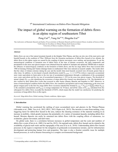
Impact of global warming on the formation of debris flows in an alpine region of southeastern Tibet, The
Debris flows are one of the typical mountain hazards in the Qinghai Tibet Plateau, and they are also one of the most active and harmful hazards in the southeast of Tibet. Different from the formation mechanism of debris-flow hazard at low altitude, the debris flows in this alpine region are caused by the coupling of glacier movement, snow melting, and precipitation. To get the meteorological conditions in formation area of debris flows at the time of disaster occurrence, the daily temperature and precipitation in the areas near glacier tongues were obtained from the method of Anulspin and optimized TRMM data to analyze the influence of meteorological conditions on the formation of debris flows, and the ten mega debris flows that occurred after 1980 in Guxiang, Peilong and Tianmo drainage basins in southeastern Tibet were selected as research samples. The results show that the values of climate extremes during the year and the month when most hazards occurred were obviously greater than at other times. In addition, we developed a hazards identification model … [please see PDF document for the full abstract].
071
Rainfall intensity limitation and sediment supply independence of post-wildfire debris flows in the western U.S.
This work explores two hypotheses related to post-wildfire debris flows: first, that they are rainstorm-intensity limited and not rainstorm-volume limited, and second, that they are not sediment-supply limited. The first hypothesis suggests that it is common to generate more than enough water to account for the volume in the debris flow, but to actually produce a debris flow the water must be delivered in sufficiently large doses. This is demonstrated by a dataset of 44 debris flows from eight burned areas in California, Colorado, and Utah. Assuming that a debris flow is composed of 30% water and 70% solids, these events were generated during rainstorms that produced an average of 17 times as much water as necessary to develop a debris flow. Even when infiltration is accounted for, the rainstorms still generated an overabundance of water. Intensity-dependence is also shown by a number of cases where the exact timing of debris flows can be pinpointed and are contemporaneous with high intensity bursts of rainfall. The hypothesis is also supported by rainfall intensity-duration thresholds where high volume storms without high intensity bursts do not generate debris flows. The second hypothesis, that of sediment-supply independence, is supported by data indicating the dramatic increase in volume of flows that occur directly after wildfire, as opposed to flows in unburned terrain. Also, repeated flows within short time intervals are only possible with an abundance of channel sediment, dry ravel, and bank failure material that can be mobilized, and field observations confirm these sediment sources, even directly after a debris- flow event.
072
Debris flows in the North Pacolet River valley, Polk County, North Carolina, USA: case studies and emergency response
The North Pacolet River valley is incised into the Blue Ridge Escarpment (BRE) near Tryon in southwestern North Carolina. The BRE is a mountain front that marks the change from the mountainous Blue Ridge physiographic province to the lower, rolling topography of the foothills zone of the Piedmont provinces. This escarpment is often comprised of steep slopes with exposed bedrock cliffs and shallow colluvial soils. The down slope sides of the escarpment have evidence of past slope movements in the form of large scale deposits, debris fans, talus slopes, and dormant debris slides. Debris flows have been documented along the BRE in multiple past storm events including those in 1916, 1940, 1996, and 2004. On May 18, 2018, debris flows again initiated near the top of the BRE slopes and travelled down to the North Pacolet River valley floor during heavy rains on soils with high antecedent moisture contents. At least 27 debris flows were initiated, travelling up to ~966 meters (~3,170 feet) down drainages below. At least 6 homes were damaged or destroyed and one fatality occurred due to these debris flows. Main highways, interstates, and multiple private roads were covered by the debris. Appalachian Landslide Consultants, PLLC (ALC) and the North Carolina Geological Survey (NCGS) responded to this emergency situation in order to provide Polk County Emergency Management information about the stability of the slopes before the arrival of Tropical Depression Alberto just 9 days after the May 18 rains. During this reconnaissance, ALC and the NCGS identified areas of potential instability in the coming rains. County Emergency Management used this information when deciding to issue a voluntary evacuation recommendation to the people of the North Pacolet River valley. This paper discusses the findings of the reconnaissance mapping, as well as a general overview of the integration of geological information into emergency response and preparation.
073
Characteristics of debris flows just downstream the initiation area on Punta Nera cliffs, Venetian Dolomites
The Piees de ra Mognes fan at the base of the Punta Nera cliffs, in the Venetian Dolomites (Italy), has been subject to debris flow activity for decades. Until recently, these debris flows never reached the National Road 51 on the valley bottom. Debris flows usually initiated at the base of an incised rocky channel in the Punta Nera cliffs where runoff is delivered to loose scree deposits of the fan. The main debris flow channel is strongly incised at the apex of the fan and splits into several minor channels at lower elevations. During the autumn 2014 and May 2016, two cliff collapses produced large debris deposits. Since then, the frequency of debris flows increased considerably because of the availability of debris deposits at very steep slope that lowered the runoff discharge needed for the debris flow initiation. In a few cases, debris flows that initiated in the rocky channel reached and interrupted the National Road 51, about 2 km downstream the well-known touristic village of Cortina d’Ampezzo. On July 2016, a monitoring station was placed at the beginning of the debris flow channel just downstream the base of the rocky channel. In the period between July and -September, the monitoring station recorded six debris flow events. Analysis of these data is used to describe the characteristics of debris flow initial routing. Moreover, we use video image analysis to investigate the velocity and depth of the surge from the 5 August 2016 event.
074
Characterizing debris transfer patterns in the White Canyon, British Columbia with terrestrial laser scanning
In the Thompson-Fraser Rail Corridor in Interior British Columbia, the Canadian National (CN) rail line traverses several alluvial fans, which are subject to occasional debris flows. Debris flows pose a significant geohazard due to the combination of high flow velocities, large impact forces, long runout distances and poor temporal predictability. When a debris flow occurs, the cost of repairs, maintenance, and construction along these single-track railway lines is compounded by the fact that these activities also impede the flow of rail traffic, which has financial repercussions for the operators. As a result, it is vital to be able to identify and prioritize the slopes that pose the greatest hazard to the rail lines. A thorough understanding of the geohazards present on site is an essential component of risk assessment. The Canadian Railway Ground Hazard Research Program (RGHRP) was established in 2003 with the aim of better understanding the natural hazards impacting railway operations across Canada. The present study is part of this initiative and focuses on an active site called the White Canyon, which is located 275 kilometers northeast of Vancouver, BC. In this study, we use terrestrial laser scanning (TLS) and panoramic imagery datasets to analyze the debris recharge patterns that develop between debris flows in a select channel in the White Canyon. TLS scans taken before and after the events provide insight into the volumes of material mobilized and how we can leverage this series of TLS data to give insight into the amount of debris accumulating in the channels prior to failure. The temporal data acquisition rate was found to have a significant influence on the amount of movement that can be interpreted from the TLS change detection analysis and panoramic images. Therefore, the temporal data acquisition rate is key consideration when using TLS to support the determination of accurate return periods on debris flows.
075
Simulation of the debris flow occurred the 15 August 2010 on Rio Val Molinara Creek (northeast Italian Alps)
On the early morning of 15 August 2010, a runoff-generated debris flow routed along the Rio Val Molinara Creek and inundated the village of Baselga di Piné (Autonomous Province of Trento, northeast Italy) with about 50000 m3 of debris. Post-event field surveys allowed both the identification of the initiation area, and the estimate of the average erosion-deposition depths on different zones of the affected area. On one hand, the map of erosion-deposition depths along the Rio Val Molinara Creek was obtained by subtracting the corresponding pre- and post-event DEMs elevation values, interpolated by using the LiDAR data of two aerial surveys carried out in 2007 and 2011, respectively. On the other hand, the map of debris deposits on the inhabited fan was obtained by integrating the direct post-event field estimates and photo interpretation. In the research, the studied debris-flow event was simulated from the triggering to the inundation through a models cascade, which relies on the sequential application of rainfall- runoff, triggering, and routing models. After that, the routing model results were compared with the observed erosion-deposition pattern in order to assess the reliability of the proposed approach. In detail, the runoff was simulated in the initiation area and then used for building the solid-liquid hydrograph. After that, the solid-liquid hydrograph was routed downstream by means of a bi- phase GIS-based cell model, previously parametrized by using approximately the same values employed for the back-analysis of two debris-flow events occurred in the Dolomites (northeast Italian Alps). The comparison between the observed and simulated erosion-deposition depths and volumes is quasi-satisfactory. This is an important research outcome since the reliability of both debris-flow hazard assessments and risk analyses based on routing models relies on the trustworthiness of model simulations. In addition, due to the scarcity of pre- and post-event topographic surveys, the map of erosion-deposition depths might become a precious data source for testing the predictive capability of debris-flow routing models proposed in the literature by other authors.
076
Post-fire rockfall and debris-flow hazard zonation in the Eagle Creek fire burn area, Columbia River Gorge, Oregon: a tool for emergency managers and first responders
The Eagle Creek Fire burned 48,832 acres (196 km2) of steep, heavily forested terrain along the Columbia River Gorge, Oregon, from September 2nd to November 30th, 2017. The Columbia River Gorge is a critical lifeline for Oregon and Washington, including Interstate Highway 84 (I-84), State Route 14 (SR-14), commercial train lines, a shipping corridor, major pipelines, and hydroelectric dams. The Gorge is also a major tourist destination and home to thousands of permanent residents. Before the Eagle Creek Fire, there was significant landslide and debris-flow hazard in the Gorge due to the steep topography and high annual precipitation (>254 cm). More than 80 landslides have been recorded in the Gorge during the last ~100 years, with 58 of these recorded in the exceptionally wet and stormy winters of 1996 and 1997. Several of these landslides damaged property, temporarily closed I-84, and interrupted train and ship traffic. There is some uncertainty on the degree to which the fire will enhance debris-flow susceptibility, because the climate, terrain and geology is different from the regions where most post-fire debris-flow research has been conducted. A large portion of the Columbia River Gorge National Scenic Area, including popular hiking trails, remains closed 18 months after the fire, and the Historic Columbia River Highway was closed for 14 months after the fire. In the aftermath of the Eagle Creek Fire, emergency managers and first responders identified the critical need for a post-fire landslide response plan and hazard map. To help meet this need, the Oregon Department of Transportation, the Oregon Department of Geology and Mineral Industries, and the U.S. Geological Survey created a landslide hazard map that combined knowledge of pre-fire landslide activity and post-fire debris-flow susceptibility. We describe how this map was created and briefly touch on how this map was integrated into the post-fire response planning.
077
Hydrogeomorphology and steep creek hazard mitigation lexicon: French, English and German
Geoscientists, researchers and engineers study and work on similar projects all over the world. The exchange of information between colleagues of different countries who work on homologous projects or in similar fields requires a common technical vocabulary. Differences in the usage of technical terms and their varying definitions in different regions of the world may constrain the transfer of knowledge, for example in guidelines. Translations of technical papers and of presentations are particularly complicated and troublesome. Moreover, writers waste valuable time when they try to find proper technical terms in a different language. This is currently the case in the fields of fluvial geomorphology and steep creek hazard mitigation since several countries are active in these domains. Papers, guidelines, and policies are published in several languages, such as Japanese, Italian, French, German, English, Korean, Chinese and Spanish. International delegates are also submitting papers to journals, presenting and participating at conferences that are predominantly in English. Finally, working groups with multinational participants have been formed to advance research and transfer of knowledge in fluvial geomorphology and steep mountain creek hazard mitigation. Therefore, standardization and better definitions of technical terms are required. We propose in this paper a lexicon of French, English and German technical terms, and their definitions, related to the fields of fluvial geomorphology and steep mountain creek hazard mitigation. This paper focuses on the most important terms. In the future, other languages and supplemental terms could be added to this document with the help of other contributors.
078
Debris flows in southeast Brazil: susceptibility assessment for watersheds and and vulnerability assessment of buildings
Debris flows is one of the primary mass movement processes in the Serra do Mar, a system of escarpments and mountains that stretches more than 1,500 km in south and southeast of Brazil. Usually, these processes cause environmental and social damages. On March 1967 only one small city was affected by 947 mm, with 115 mm on the 17th and 420 mm on the 18th and triggered numerous landslides and debris flows with the great mobilization of material, reaching a 15 km radius, causing approximately 440 fatalities. Approximately 50 years later, another city, located in the same mountain range, was affected by cumulative rainfall of 150 mm/6 hours causing deaths and houses destroyed and structural damage to bridges. Thus, the objective of this work was to evaluate of vulnerability to debris flows in some watersheds located in two cities of the Serra do Mar affected in 1967 and 2014, respectively. For this purpose, some procedures were defined: (a) the evaluation of the vulnerability of buildings, considered, for instance, the number of floors, the presence of broad terraces, large doors, windows and high walls surrounding the buildings. (b) elaboration of indicators and maps of vulnerability that consider the hazard properties, the exposure, preparedness and prevention of elements at risk; (c) elaboration of indicators and map of risk perception. The results show 38 areas with vulnerable construction to debris flows: 8%-high;70%-medium;22%-low vulnerability of buildings. As preliminary results, an inventory of damages was provided from the sectors of the affected districts and preliminary mapping of the debris flow.
079
Complexity of a debris-flow system at Forest Falls, California
Historical patterns of debris flows have been reconstructed at the town of Forest Falls in the San Bernardino Mountains using a variety of field methods (mapping flow events after occurrence, dendrochronology evidence, soil chrono sequences). Large flow events occur when summer thunderstorms produce brief high-intensity rainfall to mobilize debris, however the geomorphic system exhibits properties of non-linear response rather than being a single-event precipitation-driven process. Previous studies contrasted the relative water content of flows generated by varying intensity summer thunderstorms to model factors controlling their velocity and pathway of deposition. We hypothesize that variation in sediment discharge also results from complexity in this geomorphic system, and this paper presents ongoing empirical field studies focused on sources of complexity in three formative components of recently monitored debris-flows at Snow Creek Canyon: 1) thresholds of sediment delivery from sources at the higher reaches of bedrock canyons; 2) storage effects in sediment transport down the bedrock canyons; and 3) feedbacks in deposition and transport of sediment as flows from the bedrock canyon collect into a single active channel on a fan landform downslope. An example of the first component occurred in March 2017, when snow melt generated a rapid translational landslide/debris slide of about 80,000 m3; this sediment was deposited in the bedrock canyon, but moved no further down-gradient. A second component has been observed when accumulation of meta-stable sediments in the active channel remain in place until fluvial erosion or subsequent debris flow created dynamic instability to mobilize the mass downslope. The third component occurred in the active channel where low-water content debris flows deposited sediments that filled the channel, raising the channel grade level to levy elevation, allowing for subsequent spread of non-channelized flows onto the fan and new scouring channel pathways down fan. Assessment of spatial and temporal complexities in a debris-flow system can improve risk prediction.
080
4000-year history of debris flows in north-central Washington State, USA: preliminary results from trenching and surficial geologic mapping at the Pope Creek fan
Long-term records of the magnitude and frequency of debris flows on fans are rare, but such records provide critical information needed for debris-flow hazard and risk assessments. This study explores the history of debris flows on a fan with seasonally inhabited cabins at Pope Creek along the Entiat River about 48 km upstream from the town of Entiat, Washington. Motivation for this study was provided by the Duncan Fire, a wildfire which burned the Pope Creek basin in 2014 and resulted in debris flows and water-dominated floods on the fan between August 2014 and October 2016. We excavated and mapped seven 6-m long (2.4- m deep) trenches, mapped deposits on the surface of the fan, and constrained the ages of deposits using radiocarbon dating and the computer program OxCal. Preliminary results indicate that there have been at least 10 debris-flow events (DFEs) since 4000 cal yr BP. The mean recurrence interval between events was 433 +/-44 years, but intervals range from 724 to 20 years. The four most recent events have the shortest recurrence intervals. The largest event had an estimated sediment volume of 97,000 m3 and occurred at about 285 cal yr BP (1665 AD) during the Little Ice Age. The most recent debris-flow event that was triggered by rainstorms following the Duncan Fire was about 8x smaller than the largest event. These results may indicate that the largest DFE was triggered by an exceptional meteorological event that occurred during a cool, wet time, and that smaller DFEs were triggered by less exceptional meteorological events that occurred following wildfires.
081
Modeling frequent debris flows to design mitigation alternatives
Debris flows are a common problem in Western Washington State. One persistent location of debris flows is Slide Ridge. Glacial till deposits erode in debris flows which travel to Lake Chelan, passing through the community of Shrine Beach in Washington State. In the early 1990s an unlined debris channel was constructed from the apex of Slide Ridge to Chelan lake and a large debris basin was constructed on the upslope side of the road crossing. Every 1-2 years there is a flow large enough to fill the basin, pass over the road to continue downstream to Lake Chelan, and the road is left covered in debris. The largest debris flows since 2003 have volumes estimated to be between 803 m3 to 9863 m3. Samples show the sediment is 85% gravels and dominated by angular cobbles. A number of models are being tested for their ability to predict future debris-flow volume, maximum debris-flow height, and runout distance. Results of the modeling will be used to design and evaluate mitigation measures that include the installation of grates, nets, altering the road configuration, and combination of these measures.
082
Application of knowledge-driven method for debris-slide susceptibility mapping in regional scale
Debris-slides are a frequent hazard in fragile decomposed metasedimentary rocks in the Anakeesta rock formation in Great Smoky Mountain National Park. The spatial distribution of an existing debris-slide area could be used to prepare susceptibility map for future debris-slide initiation zones. This work aims to create a debris-slide susceptibility map by using a knowledge-driven method in a GIS platform in Anakeesta formation of Great Smoky Mountain National Park. Six geofactors, namely, elevation, annual rainfall, slope curvature, landcover, soil texture and various slope failure modes were used to create the susceptibility map. Debris- slide locations were mapped from the satellite imagery, previous studies, and field visits. A Weighted Overlay Analysis was performed in order to generate the final susceptibility map, where individual classes of geofactors were ranked and were assigned weights based on their influence on debris-slide. The final susceptibility map was classified into five categories: very low, low, moderate, high and very high susceptible zones. Validation of the result shows very high category predicted ~10%, high and moderate categories predicted 75.5% and ~14.5% of the existing debris-slide pixels respectively. This study successfully depicts the advantage and usefulness of the knowledge-driven method, which can save considerable amount of time and reduce complicated data analysis unlike statistical or physical based methods. However, the accuracy of the model highly depends on the researcher’s experience of the area and selection of respective geofactors.
083
Making sense of avulsions on debris-flow fans
Avulsions remain a critical but understudied aspect of debris-flow fans and flow hazard. A substantial body of work on fluvial systems provides a conceptual framework for understanding avulsions, but equivalent research on debris-flow systems has lagged behind. A small but growing set of field examples and analogue experiments shows that many, but not all, avulsions on debris- flow fans follow a relatively predictable ‘avulsion cycle’ that consists of (1) deposition of debris-flow material in the active channel, (2) backstepping of deposition toward the fan apex in one or more small- to medium-sized surges or flows, and (3) avulsion during a subsequent larger surge or flow that leaves the channel and establishes a new pathway down the fan. Debris flows tend to occupy persistent pathways on the time scale of individual flows, but over longer time scales (perhaps greater than ~5-20 flows, based on very limited data) flows tend to avulse to fill topographic lows, leading to compensational behavior. Avulsions may be encouraged by sequences of small- to medium-sized flows followed by a large flow, and discouraged by sequences of large flows in succession, although this idea remains speculative and needs to be tested. Avulsion frequency is important for understanding flow hazard but is poorly constrained, and cannot yet be predicted as a function of either flow or catchment characteristics. The advent of new, high-resolution topographic data from fan surfaces, coupled with methods to estimate the timing and abandonment of deposition on a wide range of fans, should allow us to begin to make some initial estimates of avulsion frequency and to understand the key controls on the timing and pattern of avulsions.
084
Morphology of debris flow deposits from a 1967 event in Caraguatatuba, Serra do Mar, Brazil, The
Morphological characteristics of debris-flow deposits are a fundamental part of the field study of the process. The deposits show aspects related to flow dynamics, which reflects its main mechanics and enables the correct identification of process. Occurrences of debris flows are quite common in Brazil, especially in the Serra do Mar region, located at the southern/southeastern coast of the country. Geological and geomorphological characteristics and high rainfall indexes contribute to high susceptibility of the process in the region. In one of those occurrences, in the summer of 1967, the city of Caraguatatuba was intensely affected by high rainfall far above the average, with maximum values in between the 17th and 18th of March (586 mm/48h), which triggered landslides and debris flows that destroyed the city. In this way, the goal of this research was the morphological characterization and identification of debris-flow deposits from the 1967 event, in Caraguatatuba, Serra do Mar/Brazil. To achieve this goal, the following steps were made: a) selection of watersheds hit by debris flows; b) mapping of the debris-flows deposits in field surveys; and c) identification of morphological characteristics of deposits, applying field records. The results showed that the deposits mapped presented common characteristics described in literature as typical of debris flows, highlighting the presence of inverse grading, lateral levees and large boulders. The watersheds showed differences related to morphology types of deposits, indicating the influence of its characteristics in deposition. Those results contribute to the study of debris flow, mostly to identification of susceptible areas but also to mitigation actions promoted by the government, aiming to improve land use planning, avoiding occupation of those areas by population.
085
Santa Lucía landslide disaster, Chaitén-Chile, The: origin and effects
On December 16, 2017, a rockslide was triggered in the headwaters of the Burrito River (Chaitén district, 43.4° SL) which produced debris and mud flows that flooded Villa Santa Lucía, destroying half of the town’s urban area. These mass wasting events covered an area of 3 square-kilometers on Rute 7 and 1 square-kilometer on Rute 235, which resulted in twenty-one fatalities and one person still missing. The rockslide was produced by an intense rainfall which took place on the 15th and 16th of December, same year. The rainfall’s measured depth totaled 122.8 mm in only 24 hours, with a high isotherm of 0° (2.700 m asl). This event was preceded by a two-week-long period of high temperatures (22°C daily maximum) previously registered. The main playing factors were the presence of deeply altered volcanic rocks (clay-iron oxides) of the Cordón Yelcho Pleistocene Volcanic Range (SERNAGEOMIN- BRGM 1995) plus vertical fractures, open cracks and very steep slopes. The rockslide impacted a covered glacier and ice-cored moraine that resulted in a very high-speed blast, followed by large debris and mud flows that traveled a distance of 8 kilometers, deeply eroding the Burrito valley walls including its forest, soil and sediments (Duhart et al., 2018). A 7.2 x 10⁶ m3 total of sediments, water, ice and vegetal coverage were estimated and about 2 x 10⁶ m3 were deposited on a 9 x 10⁵ m2 fan area, covering the northern area of Santa Lucía village. An average velocity of 72 km/h was estimated for the higher part of the flow (Fernandez et al., 2018), although the initial blast was higher due to the trees that were uprooted and torn alongside the valley walls. As of today, the rockslide scar is still unstable with steep slopes, open cracks, a prominent hanging block and vertical fractures. A Laser Scan monitoring test was developed and is currently under assessment design. The implementation of permanent monitoring beneficial to the understanding of the rock’s failure origins in the generation zone may enhance the development of an alert system for landslide hazard risk reduction.
086
Debris flow risk management in practice: a New Zealand case study
In 2005 the settlement of Matatā on Awatarariki fan, Bay of Plenty, North Island, New Zealand was devastated by a >3 x 10⁵m3 debris flow; several dwellings were destroyed and many damaged, but no fatalities occurred. In the 7 years following the event, design options for a debris-flow containment structure in the catchment were developed. Following a formal determination by the Government’s building control agency in 2006, building consents were granted for a number of replacement dwellings on the fan. In 2012, the previously chosen containment structure project was cancelled due to effectiveness and cost concerns. Subsequent investigations confirmed there were no viable engineering solutions to manage debris-flow risk from this catchment, and risk analyses have demonstrated that no debris-flow management systems, warning and evacuation systems, or individual dwelling protection mitigation measures, independently or in combination, could deliver a residential environment with tolerable risk-to-life levels. Since 2013, Whakatāne District Council (the Council) has been working towards a non-legislated managed voluntary retreat from the area where the risk to life is greater than about 10-4a-1, which is also the area of boulder deposition in the 2005 event. This has involved many meetings with affected landowners, including legal counsel and experts, but the currently 13-year delay in resolving uncertainty about landowners’ futures has generated considerable stress and even hostility. A parallel legislation-based workstream the Council has undertaken to fulfil its statutory responsibilities has exacerbated tension between the Council and some property owners. From a technical perspective, this study emphasises the danger of lay officials and consultants placing too much confidence in immature technologies to reliably modify debris-flow occurrence. From a public management perspective, it highlights the immaturity of New Zealand’s natural hazard management policy framework, in particular the significant disconnect between policy intent and policy implementation and its polarising effects on a small provincial community.
087

Post-fire debris-flow hazard analysis for interstate 80, Truckee River Canyon, near the California-Nevada state line, USA
On July 9, 2017, west of the California-Nevada state line, USA, the 2.8 km² Farad fire burned steep slopes above Interstate 80. On the evening of August 18, 2017, a localized convective storm produced short-duration, moderate-intensity rain, which in turn triggered debris flows in a historically inactive basin. These flows impacted Interstate 80. At least four additional debris flows, not related to wildfire, have occurred along this section of road since 2013, but during much higher intensity rainfall. Here we utilize the history of pre- and post-fire debris flows along this section of Interstate 80 to explore the impacts of wildfire on debris flows. Specifically, we combine pre- and post-fire rainfall data and field measurements with empirical debris-flow models to quantify the impacts wildfire had on debris-flow generation and to estimate the likelihood and magnitude of future events. A characteristic pre-fire debris flow occurred on July 25, 2013 in a susceptible path ~30 minutes after rainfall began and during peak 15-minute intensities of ~50 mm/hr. This event closed both east and westbound lanes of Interstate 80. No other nearby paths had debris flows during this rainstorm. In contrast, one month post-fire, on August 18, 2017 a debris flow occurred in a historically inactive path, but within an area of high burn severity. Debris-flow initiation occurred ~30 minutes after the beginning of rainfall, but with peak 15-minute intensities of only ~26 mm/hr. This amplified rainfall-runoff response is consistent with fire-induced changes in soil hydraulic properties for which we measured post-fire decreases of a factor of 2 in field-saturated hydraulic conductivity and a factor of 4 in sorptivity. From field measurements, total volume estimates for the August 18, 2017 post-fire debris-flow event ranged between 1270 and 4700 m3 depending on assumptions regarding pre-event channel geometry and volume of hillslope sediment transported. A shallow landslide that liquefied and flowed into the channel contributed ~450 m³ of material and was apparently triggered by concentrated overland flow off an old road into the toe slope of a much older deep- seated landslide. Debris flows eroded most of the travel path above the fan to bedrock and contributed >850 m³ of debris, at a nearly uniform spatial rate, both of which suggest this event was likely limited by sediment availability. Just 100-150 m above Interstate 80 the flow transported boulders with maximum diameters in excess of 1 m, at peak velocities of ~2-5 m/s. We used the analysis of the August 18, 2017 debris-flow event to verify empirical equations developed by the USGS for predicting the probability, total volume, and runout distance of post-fire debris flows. We found good agreement between model output and observations and hence used these equations to predict characteristics of debris flows likely to occur in the near future.
088
Debris-flow risk assessment and mitigation design for pipelines in British Columbia, Canada
Pipelines in mountainous terrain in British Columbia, Canada often cross debris-flow fans and channels along valley bottoms and can be susceptible to various geohazard impacts, including debris flows. The design of new pipeline infrastructure and maintenance of existing pipelines necessitates debris-flow risk assessments and appropriate mitigation design. A methodology is presented for assessing debris-flow risk along pipeline routes that consists of estimating the probability of a debris flow causing a pipeline loss of containment or disruption in service. The methodology consists of estimating debris-flow frequency, scour potential, and the vulnerability of the pipeline to break if impacted. Debris-flow frequency is estimated based on field observations of debris-flow deposits, degree of vegetative growth on debris-flow deposits, evidence of debris-flow impacts on trees near the pipeline crossing, documented debris-flow events, review of historical air photos and terrain mapping based on LiDAR-generated topography. Debris-flow scour potential is estimated based on channel morphology, presence of bedrock and grain size distribution of channel bed material. Vulnerability is estimated based on flow width and velocity and can be modified for different pipe diameters and wall thicknesses. Mitigation options for buried pipelines include those intended to decrease the likelihood of bed and bank scour (e.g. rip rap bed and bank protection), decrease the likelihood of the pipeline being exposed (increasing the burial depth of the pipeline) and to increase the resiliency of the pipeline to debris-flow impacts if exposed, (e.g. increasing pipeline wall thickness, adding concrete coating to the pipeline). The final option is to prevent debris flows from reaching the pipeline by designing and installing debris-flow deflection berms or sedimentation basins. The methodology presented is embedded in risk-informed thinking where pipeline owners and regulators can define probability thresholds to pipeline exposure or rupture and the pipeline designer needs to show that the proposed mitigation measures achieve these threshold criteria in ways that honor the ‘as low as reasonably practicable’ (ALARP) principle.
089
Overview of a decade of applied debris-flow runout modeling in Switzerland, An: challenges and recommendations
Dynamic debris-flow runout models are applied by practitioners (1) to generate hazard maps, (2) to help design mitigation measures such as dams and warning systems, (3) to explore potential impacts of rare events such as pro-glacial lake failure, and (4) to illustrate the hazard process to local decision makers and stakeholders. Automated observations of debris flows in several torrents have shown a large degree of variability in the flow process, ranging from fast muddy debris floods to relatively slow debris flows with granular fronts, at any given torrent. It is not yet possible to predict with certainty which type of debris flow can be expected in any given catchment. The prediction problem is amplified by the fact that topographic data are generally coarse (2m horizontal resolution in Switzerland) compared with typical channel widths (1–10 m) and because channel topography changes with time. These challenges and their impact on hazard assessment is illustrated using recent examples of typical applied projects. Herein we use the RAMMS debris-flow runout model. However, the general procedures presented here are applicable to other similar runout models. Common points in these examples include the accurate assessment of potential erosion, deposition, and avulsion along the channel, as well as the systematic modification of the friction coefficients in the model to account for variations in water content, sediment size, channel-bed roughness, and other properties of the flow. We mention the main challenges in these steps, as the exact procedure is still not clearly regulated in Switzerland. In general, it is desirable to work with several scenarios to account for multiple flow surges and the erosion and deposition produced by each surge, and uncertainties in the expected debris-flow type (granular vs. muddy). Thus, for the generation of appropriate scenarios, experience in the field and with the use of runout models is essential.
090

Analysis of rainfall and runoff for debris flows at the Illgraben catchment, Switzerland
For hazard analysis, scenario design and mitigation there is a need to accurately and objectively predict the volume of debris flows. One approach is to base the calculation on rainfall properties. Herein we present an analysis of rainfall and debris-flow volume using data from the Illgraben catchment in Switzerland. The Illgraben debris-flow observation station, operated starting in the year 2000, has successfully recorded 75 debris flows and debris floods, with volume and bulk density estimates available for most of these events since 2000 and 2004, respectively. Here we describe results for 52 debris flows with sufficient data. Runoff coefficients determine the proportion of precipitation discharged from a catchment and support estimates on flow magnitudes. For each debris flow, runoff coefficients were determined by considering the event rainfall and the water contained in the debris flow. The events can further be characterized by the 14-day antecedent wetness. Runoff coefficients comprise a wide range from near 0 to close to 1. Clear trends are apparent, such as larger runoff coefficients during the snowmelt season. Furthermore, the debris-flow volumes are more sensitive to the antecedent rainfall than to the rainfall amount that triggered the event, likely because a wet channel bed enhances entraining. This study gives insights on which climate variables control the debris-flow volume. This will be further investigated and incorporated into the SedCas (Sediment Cascade) model (Bennett et al., 2014) to improve prediction of debris-flow activity.
091
Debris flow assessment from rainfall infiltration induced landslide
In the study, debris flows induced by landslides are studied through physical models. TRIGRS and DEBRIS-2D models are integrated for simulation of rainfall infiltration induced shallow landslide and the subsequent debris flows. TRIGRS is used to estimate unstable mass on the hillslope and provide the initial volume for debris flow simulation, and DEBRIS-2D is applied to simulate mass motion and assess the hazard zone mapping. The method is applied to Daniao tribe’s sediment disaster during Typhoon Morakot in Taiwan. The simulated final deposition zone and the disaster area in the real event are almost identical. All the geophysical parameters are obtained through official values and rheological parameters are obtained by in situ measurements.
092

Study of prediction methods of debris-flow peak discharge
Prediction of peak discharge of debris flow is one of the most important factors to mitigate debris-flow disasters. In general, peak discharge of debris flow has been either measured at the observation sites directly or estimated based on debris-flow velocity and cross-sections derived via field investigations (e.g., Mizuyama et al., 1992; Rickenmann, 1999, 2016). Based on these data, peak discharge of debris flow has been estimated from various aspects: (a) theoretical formulae, numerical simulations and laboratory flume experiments; (b) peak flood discharge using rational formulae; and (c) empirical methods based on the relationship between the peak discharge and total debris flow volume (magnitude) for many debris flow events (e.g., Takahashi, 1991; Mizuyama et al.; 1992, Ikeda et al., 2015). Peak discharge and magnitude of debris flow measured via direct observation are reliable. Although, while residual markings do not always accurately indicate riverbed and cross-sections during the debris flow, as revealed by field investigations. Also, no generally accepted prediction method of field investigation has been developed, therefore it is difficult to compare peak discharge and magnitude of debris flow among various sites. To date, to estimate peak discharge of debris flow, the focus has been on riverbed and cross-sections. The depth and length of riverbed deposits (riverbed sediment volume) between initiation zone of debris flow and downstream evaluation points cannot be used to accurately estimate magnitude. Here, we (i) improve the unified accurate prediction method of peak discharge and magnitude of debris flow via field investigations; (ii) compile and update data on numerous recent debris flows in Japan; (iii) analyze properties of peak discharge of debris flow in different occurrence type and the relationship between peak discharge and magnitude of debris flow; and (iv) offer the practical prediction method of peak discharge of debris flow.
093
Debris-flow hazard assessments: a practitioner’s view
Substantial advances have been made in various aspects of debris-flow hazard and risk assessments over the past decade. These include sophisticated ways to date previous events, runout models including multi-phase flows and debris entrainment options, and applications of extreme value statistics to assemble frequency-magnitude analyses. Finally, quantitative risk management (QRM) has emerged as the most rational and defensible method to assess debris- flow risk and optimize mitigation efforts. Pertinent questions, of course, have remained the same: How often, how big, how fast, how deep, how intense, how far and how bad? Similarly, while major life loss attributable to debris flows can often, but not always, be avoided in developed nations, debris flows remain one of the principal geophysical killers in mountainous terrains. Substantial differences persist between nations in hazard or risk management. Some rely on a design magnitude associated with a specific return period, others use relationships between intensity and frequency, and some allow for, but do not mandate, in-depth quantitative risk assessments. The range in return periods considered in hazard and risk assessments varies over two orders of magnitude from 1:100 to 1:10,000. In many nations, access to funding and lack of at least regional prioritization provides the biggest obstacles to widespread safeguarding against debris flows. Two factors conspire to challenge future generations of debris flow researchers, practitioners and decision makers: Population growth and climate change. The former will invariably invite continued development in debris-flow prone areas, especially fans, floodplains and terraces subject to lahars or landslide/moraine dam/glacial outburst floods which, at times, assume debris-flow characteristics. As far as debris flows are concerned, climate change is manifesting itself increasingly by augmenting hydroclimatic extremes, especially a several-fold increase in the frequency of short-duration high-intensity rainfall that may soon exceed historical precedents. While researchers will undoubtedly finesse future remote sensing, dating and runout techniques and models and bring some of those to a degree of maturity, the practitioners will need to focus on translating those advances into practical cost- efficient tools and closely collaborate with clients to integrate those tools into meaningful long-term debris-flow risk management. Future debris flow disasters will not occur due to a lack of quantitative methods, but likely due to the lack of recognition, wilful ignorance of debris-flow hazards, lack of enforcement of risk management policies, or simply a lack of means to mitigate against known debris flow risks.
094

Evaluation of shallow landslide-triggering scenarios through a physically based approach: a case study from Bulathsinhala area, Sri Lanka
Transient Rainfall Infiltration and Grid-based Regional Slope-stability analysis (TRIGRS) is a regional, physically based stability model which could be applied to predict shallow landslides. It is important to evaluate the accuracy of TRIGRS for the prediction of landslide locations using actual events before use the TRIGRS model for further applications. This study presents the application of TRIGRS for Bulathsinhala area, Kaluthara in south western part of Sri Lanka where the number of shallow landslides occurred on 26th May 2017 and many of those events transitioned into damaging and killing debris flows. A back analysis of that landslide event was executed to authenticate the model by using different methods and techniques for the definition of the input parameters. Reliability of the model was evaluated through comparison with the 2017 landslide inventory in the particular area and it was revealed that most of the actual landslides were occurred in the predicted area (FS<1) of the model. In order to quantify the effectiveness of the model, an index was proposed in the study called LRclass (landslide ratio for each predicted FS class). The obtained values of the LRclass index realize the trustworthiness of the model which indicates the considerably higher value (60%) for the lowest stability class. With this particular manner, the output of the study could be used to implement more reliable land use management and development plans and resettlement procedures. Further the TRIGRS model is advantageous for susceptibility mapping and landslide flow path analysis, particularly when linked with various advanced applications using GIS spatial functions.
095
Hydro-meteorological trigger conditions of debris flows in Austria
Different factors influence the disposition of a watershed for initiation of debris flows, including meteorological trigger conditions as well as the hydrologic and geomorphic disposition. The latter includes slowly changing factors like relief energy or sediment availability, whereas the hydrologic state of a watershed may vary over short time scales. This contribution summarizes the outcomes of a long term project to quantify meteorological and hydrological trigger conditions leading to debris flows at different temporal and spatial scales in the Austrian Alps. The analysis employs a database of more than 4,500 debris flows over the last 100+ years, which is the period for which systematic rainfall data is available. A Bayesian analysis was carried out for determining occurrence probabilities for all Austria. For selected regions, hydrological trigger conditions were assessed using a semi-distributed, conceptual rainfall-runoff model, which was calibrated to measured runoff data. As expected we find increasing trigger probabilities with increasing rainfall amounts and intensities. However, the additional information of regional hydrological parameters as well as their temporal evolution over days prior to a debris-flow event, enables to capture different trigger conditions, including short duration rainstorms, long lasting rainfall events, and snow melt. We also find that a trigger-type resolved prediction of debris-flow susceptibility based on the hydro-meteorological catchment information is superior to simple rainfall-only approaches. The results of this analysis shall improve our understanding of long-term trigger conditions and trends of extreme mass wasting processes in the Alps and aim to become a valuable tool in engineering hazard assessment.
096
Weather-radar inferred intensity and duration of rainfall that triggered the January 9, 2018, Montecito, California, disaster
Slopes above Montecito burned by the Thomas Fire in December 2017 produced disastrous debris flows in response to a short period of intense precipitation on January 9, 2018, killing 23 people, injuring many others, destroying and damaging residential buildings, and community infrastructure. The intense precipitation was in a narrow cold frontal rainband which obviously exceeded the intensity and duration threshold for post-wildfire debris flows. Rain gauges with self-activating radio transmitters reported by County of Santa Barbara Department of Public Works documented the precipitation in the Montecito area as it occurred, which allowed short-duration intensities to be calculated. Data from the rain gauge on Montecito Creek was used in this paper and showed that the rainband that produced the precipitation that generated the debris flows passed over Montecito in about one-half hour. Two weather radar stations operated by the National Weather Service are located within about 100 km of Montecito. Both stations were operational and recorded radar reflectivity on a frequency of about five minutes during the entire storm; data from the KVTX station located east of Montecito was used for this paper. Montecito is located on a coastal plain south of the Santa Ynez Mountains, which shield the lower elevations in the Montecito area from direct view of the radar stations. Composite radar reflectivity represents the amount of water droplets in the atmosphere in line-of-sight above the ground. The weather radar shows patterns similar to the precipitation documented by the rain gauges. Radar reflectivity at the coordinates of the rain gauge on Montecito Creek and at the coordinates of a point in the Santa Ynez Mountains on the west side of the Santa Ynez Creek watershed was extracted and converted to an approximate rainfall depth using a general National Weather Service relationship. The results are used to demonstrate the value of weather radar reflectivity for visualization and for developing approximate rainfall intensity and duration estimates at positions of interest remote from rain gauges for comparison with post-wildfire debris-flow thresholds.. The analysis in this paper was developed as part of the Geotechnical Extreme Event Reconnaissance (GEER) Association response to the Montecito disaster.
097
Review of contemporary terminology for damaging surficial processes: stream flow, hyperconcentrated sediment flow, debris flow, mud flow, mud flood, mudslide
The term “mudslide” seems to be favored by news media for all localized processes in which damage is caused by moving earth materials, regardless of whether the processes involved mud or sliding. The term came into prominence sixty years ago when an atmospheric river moved over southern California with disastrous landslides, debris flows, and floods. Very costly floodlike damage resulting from “mudslides” was added to the National Flood Insurance Program coverage as a result of the 1969 disaster. Landslides were, and still are, excluded from the flood insurance program and other insurance instruments. Because of lack of clarity in what range of phenomena was intended to be covered by the flood insurance program, a panel of experts assembled by the National Research Council (NRC) categorized the continuum of moving water to moving earth into (1) clear-water floods, (2) mud floods, (3) mud flows, and (4) other landslides. These categories recognize the lack of clear distinction between slope-movement classifications and floodlike damage caused by more fluid “landslides.” Earth materials in the most recent landslide classification are subdivided into rock and soil; soil is further subdivided into debris and earth. Debris is composed of mineral fragments with 20 to 80 percent coarser than sand size, whereas earth is 80 percent sand and finer fragments. Mud was used in older geology-based classifications in a way similar to earth (e.g., mudstone). Mud is not a technical term in engineering usage. Sediment-water mixtures with sufficient water to behave hydraulically were called mud floods by the NRC. Mud flows differ from mud floods by having viscoplastic behavior, which allow mud flows to support fragments with densities greater than water during transportation and when the mass comes to rest. Mud flows and debris flows have a velocity-dependent strength (matrix viscosity) and a velocity-independent strength (shearing resistance of the mass). As a mud flow or debris flow slows to a stop, the velocity-dependent strength goes to zero; however, dense fragments do not sink or settle into the mass because of its static shearing resistance. The deposits of this spectrum of processes have distinctive sedimentary structures: clear-water flood deposits are stratified, graded, and fining upward; debris-flow deposits are unsorted, unstratified, and fully matrix supported; hyperconcentrated-flow deposits are fully clast supported. Debris-flow deposits may contain megaclasts, if they are available in the source area. Geoscientists and engineers need to understand contemporary terms used in the media to communicate with emergency managers and a variety of non-specialists, but also should recognize characteristics that are associated with specialized technical terms.
098

Evaluation of slope stability of Taebaeksan Mountain National Park using detailed soil map
More than 64% of Korea’s land is occupied by mountain regions, which have terrain characteristics that make it vulnerable to mountain disasters. The trails of Taebaeksan Mountain National Park—the region considered in this study—are located in the vicinity of steep slopes, and therefore, the region is vulnerable to landslides and debris flow during heavy storms. In this study, a slope stability model, which is a deterministic analysis method, was used to examine the potential occurrence of landslides. According to the soil classification of the detailed soil map, the specific weight of soil, effective cohesion, internal friction angle of soil, effective soil depth, and ground slope were used as the parameters of the model, and slope stability was evaluated based on the DEM of a 1 m grid. The results of the slope stability analysis showed that the more hazardous the area was, the closer the ratio of groundwater/effective soil depth is to 1.0. Further, many of the private houses and commercial facilities in the lower part of the national park were shown to be exposed to danger.
099
Estimation of debris-flow volumes by an artificial neural network model
Estimating debris-flow volume is an essential requirement for hazard assessment in mountainous areas. A number of studies have been conducted on the estimation of debris-flow volumes using empirical, statistical, and physically-based methods. Despite such efforts, the prediction of erosion and deposition processes in mountainous terrain remains a challenging task due to the complexity of the issue and lack of data. In this study, data on a total of 30 debris-flow events observed in Mt. Umyeon, Seoul, Korea, which consist of eight GIS-based geomorphological and hydrological datasets, were collected from technical reports, scientific journals, aerial photographs, and DEM. The collected datasets were applied for a correlation analysis to ensure independency among the variables in a dataset and to avoid the over-fitting the data with a model. Using an Artificial Neural Network (ANN) technique, an estimation model of debris-flow volume was developed and tested by randomly selecting a validation dataset. The final ANN model consisted of one hidden layer with 5 neurons and exhibited training, and testing correlation coefficient (R) values, and mean square error (MSE) value of 0.92, 0.88 and 0.25, respectively. In order to verify the applicability of the suggested model, the performance of the model was compared with an existing regression equation. The results showed that the suggested ANN model possessed greater predictive capabilities and could serve as a reliable tool for estimating the debris-flow volume. However, additional factors that affect debris-flow volume should be studied for the development of a higher performance model.
100
Post-fire debris flows of 9 January 2018, Thomas Fire, southern California: initiation areas, precipitation and impacts
The post-fire debris flows of 9 January 2018 killed 23 people, destroyed over 130 homes, and caused severe damage to infrastructure in Montecito and Carpinteria, California. Highway 101 was closed for 13 days, significantly impacting transportation and commerce in the region. Collectively, debris flows from this event are comparable in magnitude to the largest documented post-fire debris flows in the state, inundating over 4 km2 of land, and costing the Santa Barbara region over half a billion dollars in debris removal and damages to homes and infrastructure. Here, we document the extent and magnitude of inundation areas, debris- flow volumes, and source areas. Additionally, we describe the atmospheric conditions that generated intense rainfall and use precipitation data to compare debris-flow source areas with spatially associated peak 15-minute rainfall depths. We use a compilation of debris-flow damages to summarize economic impacts associated with the event.
101
Debris-flow susceptibility mapping in Colorado using Flow-R: calibration techniques and selected examples
The Colorado Geological Survey (CGS) has been using ArcGIS in combination with Flow-R to prepare county-wide debris-flow susceptibility maps for 43 counties in 13 priority areas comprising the mountainous portions of the state. Limited personnel, site access, and limited records of recent events constrain the CGS’s ability to calibrate models based on historical data or field observations. In response to these limitations, the CGS has developed methods to parameterize county-wide debris-flow source area and inundation area models in characteristic regions using recently available high-resolution (e.g., 1 m) digital elevation data. Method development has been continually evolving. The current process relies on an analyst who selects a subset of drainages of various sizes from unique regions within each county and manually identifies potential debris-flow source and deposition areas based on the digital terrain data or, if available, historical aerial imagery. The analyst records characteristics of identified source areas and initiates a series of test runs using a range of potential inundation area model parameters. The analyst visually interprets the source-area characteristics and inundation area model results and selects a single set of parameters to apply to similar drainages across the county. This paper presents current parameterization methods and discusses anticipated future improvements.
102
Landslides and debris flows in volcanic rocks triggered by the 2017 Northern Kyushu heavy rain
About 200 landslides and debris flows occurred in Northern Kyushu during heavy rain at Asakura City, Toho Village, Hita City on July 5th to 6th, 2017. At Hita City, the total precipitation during this two-day event was 402.5 mm. At Asakura city, underlain by granitic rocks and schist, shallow landslides dominated. Whereas, at Toho Village and Hita City, which is underlain by volcanic rocks, the number of landslides and debris flows are fewer, are larger and deeper, than those at Asakura City. We examined the geomorphology and geology at 19 landslides in volcanic rocks, 11 of which mobilized as debris flows. We studied the initiation mechanism of landslides underlain by volcanic rocks. The geology consists of pyroclastic rocks and lava flows in ascending order. The lava flows are distributed at ridges and contain vertical cooling joints. Scarps of landslides caused by the 2017 rain are located near the boundary of pyroclastic rocks and lava flows. The sliding surfaces of these landslides are at the contact between the lava flows and the pyroclastic rocks. We consider, therefore, that the trigger for these landslides was a decrease of strength at the contact caused by an increase in groundwater pressure caused by infiltration of rain water through the cooling joints in lava flows. Therefore, we conclude that the landslides caused by the 2017 heavy rain at volcanic rock fields are cap rock type landslide. Furthermore, the curvature of the hillsides downslope from landslides is concave, which may be a required condition for debris-flow mobilization.
103
Debris-flow occurrence in granite landscape in south-southeast Brazil
The widespread occurrence of Granite Massif landscapes in the Serra do Mar Range, south-southeast Brazil, is also connected with high incidence of debris-flow events. In recent years, the debris-flow events in Serra do Mar Range have caused many deaths and great infraestructure losses. These events occur in high gradient watersheds covered by a thin regolith. This paper intends to analyse the connection between debris-flows-prone watersheds and granitic regolith. These rocks, quite abundant along the mountain chain, are resistant to weathering, and present large vertical gradients. In addition, they generate porous and cohesive regoliths, which support infiltration to the rain water. When saturated, these regoliths can generate shallow landslides, which can liquefy and flow along channels, depositing this material in colluvial fans in piedmont areas. From this point of view, we analysed two watersheds in a granitic terrain, both of similar size and that recently suffered catastrophic events of debris-flows: 1) the Guarda-Mão creek watershed in Itaoca region, which had an intense meteorological event in January 2014; 2) the Gigante creek watershed, in Serra da Prata, which suffered an event with nucleation of debris-flows in March 2011. Both basins present themselves a thin regolith and rock outcrops in higher areas, grading to thicker regoliths and colluvium deposits in the foothills, where the gravels are deposited in the colluvionar fan. Both basins have soil densities (s) between 2.4 and 2.7 g/cm³, reflecting the presence of primary (quartz, feldspar) and secondary minerals (illite, kaolinite, montmorillonite and iron oxides). Both materials are porous (32% to 44%), with plasticity indices (PI) between 1% and 17%. Most materials have low plasticity, although the Gigante creek watershed is even lower, between 1 and 5%. The analysed watersheds are typical of granite/granitoid terrains in Serra do Mar Range, and present great similarity. Further studies should consider the morphometric characteristics of these basins, the mechanisms of rupture and the regoliths liquefaction processes, besides modelling the deposition in fan areas. This understanding could bring improvements to disaster risk management strategies throughout the Serra do Mar region.
104
Hillslope evaluation in the vicinity of the Wolsong nuclear power plant after 12th September 2016 Gyeongju earthquake, South Korea
Landslides result not only from the environmental background conditions of slopes but also from triggering factors, such as rainfall and earthquake. Severe landslides and debris flows are common natural disasters in South Korea since it is characterized by high rainfall and rugged topography. A secondary effect of an earthquake could be slope instability. A 5.8-magnitude (ML) earthquake, the most powerful seismic activity since the nation started measuring tremors, struck the historic city of Gyeongju, North Gyeongsan Province, at 20:32:54 KST. The Wolsong nuclear power plant is situated in the foothills of a mountainous area about 26 km SE of the earthquake epicenter. South Korea’s biggest historical earthquake raised the nuclear safety concerns. To assess regional landslide hazard under the conditions of heavy rainfall and after 5.8 ML Gyeongju earthquake, this study, a coupled hydrological model with infinite slope model was used to find the hillslope stability under the roles of rainfall and earthquake.
105
Historical debris-flow occurrence in Rocky Mountain National Park, Colorado, USA
Debris-flow characteristics of initiation and runout are compared across the Continental Divide in Rocky Mountain National Park (RMNP), Colorado, USA to evaluate the influence of lithology, topography, and anthropogenic activities. Previous research indicates that 30 debris flows within the last century were large enough to transport sediment to valley bottoms and main stem channels and create new debris fans. Ten of the debris flows occurred on the east side of the Continental Divide and 20 on the west side. Those on the east side initiated after an extreme rainstorm in September 2013, whereas those on the west side occurred on the hillslope below an earthen ditch (12 flows) or on the natural hillslope (8 flows). Of those on the west side, four of the five largest debris flows initiated at the ditch. Comparing debris-fan area, transport distance, and elevation of initiation, we find greater variability in transport distance and elevation from east side debris flows, some of which entered alluvial channels and traveled >4 km under highly fluidized conditions. In contrast, the presence of the ditch on the west side limited the elevation of initiation, contributing area and hence, debris-flow transport distance. Lithologic differences between the east and west sides influences debris-supply conditions. On the east side, weathering-limited basins reduce source material and require a longer time to recharge convergent topographic source areas. Transport-limited hillslopes on the west side provide ample source material for debris flows, including till deposits and weathered volcanic rocks. Fan areas are comparable, and debris-flow morphology is generally similar across the Continental Divide. Recent anthropogenic and climatic disturbances, however, indicate that new patterns of debris-flow occurrence must be considered in the future. The increased occurrence of debris flows is an alert to park management who address hazards and risks to park staff, visitors and infrastructure. Furthermore, the high elevation of initiation for these modern debris flows expands the range of expected debris-flow hazards.
106

Debris-flow initiation promoted by extension of a slow-moving landslide
The dynamics of slow landslide motion can predispose oversteepened and extended slide regions to debris-flow initiation. For more than 20 years, our real-time monitoring, combined with repeat high-precision GPS surveys, of the Cleveland Corral landslide complex, California, USA, reveals that debris flows initiate from slow-moving kinematic elements of this complex. Different slide elements move in different wet years, and all remain dormant in dry years. To explore controls on landslide- element kinematics, we use triaxial testing to define the critical state behavior of the landslide material, and use a large-diameter sampling ring to determine in situ material porosities in both extensional and compressional regions of the slide complex. Regions undergoing extension contain materials looser than their critical state, potentially aiding liquefaction and debris-flow mobilization from shallow, secondary slides. Although intense rainfall serves as a trigger for debris-flow initiation, slow deformation of the larger landslide promotes debris-flow formation by oversteeepening toe and lateral margins and by preferentially extending, and effectively loosening, material in these steep regions.
107
Regional level debris-flow hazard assessment for alpine infrastructure facilities using the 3D numerical high-performance simulation tool FIMT
Alpine infrastructure such as roads, railways, pipelines, powerlines and hydropower facilities, as well as alpine communities, are exposed to debris-flow hazards, rock-fall and snow avalanches. In most cases, debris-flows are rainfall induced and affect large areas, causing substantial financial and individual damages. Austrian infrastructure owners are maintaining approximately 5,000 km of railway tracks and at least 1,000 km of high priority highways which are exposed to debris-flow hazards. For assessing potential debris-flow impact along these infrastructure routes, the stand-alone physical-numerical based modeling tool FIMT (Flow Impact Modeling Tool) was developed in-house by ALPINFRA, which is applied on a 3D topography with a spatial resolution of 5x5m. The model is applied on a regional scale and areas with more than 3,000 km² were analyzed simultaneously. Debris-flows are highly dynamic, complex flow processes of multi-phase fluids with a constantly varying flow regime during single events and along flow paths. Many researchers, including Pudasaini et. al., 2005, Wang et. al., 2004 and Iverson, 1997, 2001, 2004 provide well developed physical approaches for single- and multi-phase fluids. The Mohr-Coulomb based friction model of Voellmy (1955) however, provides an acceptable and numerically implementable alternative, considering dry friction as well as hydraulic driven parameters. This approach was initially developed for snow avalanches and is now implemented in various debris flow and other rapid mass movement modeling software tools. Ahead of the implementation of the model for regional hazard assessments, ALPINFRA conducted calibration and parametric studies. These were done in test-regions and based on extensive field work, investigation of historical events and detailed numerical back analysis. Since 2013, all parts of the Austrian railway network exposed to debris-flow, major Austrian highways, as well as gas-pipelines and hydro power facilities have been analyzed with this tool as a basis for hazard and risk studies. For regional scales, simulation results have a comparatively high resolution (5x5m) and build a high-quality basis for hazard mapping, budgeting of mitigation measures and planning of detailed investigation projects.
108
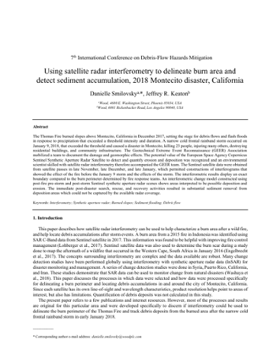
Using satellite radar interferometry to delineate burn area and detect sediment accumulation, 2018 Montecito disaster, California
The Thomas Fire burned slopes above Montecito, California in December 2017, setting the stage for debris flows and flash floods in response to precipitation that exceeded a threshold intensity and duration. A narrow cold frontal rainband storm occurred on January 9, 2018, that exceeded the threshold and caused a disaster in Montecito, killing 23 people, injuring many others, destroying residential buildings, and community infrastructure. The Geotechnical Extreme Event Reconnaissance (GEER) Association mobilized a team to document the damage and geomorphic effects. The potential value of the European Space Agency Copernicus Sentinel Synthetic Aperture Radar Satellite to detect and quantify erosion and deposition was recognized and an environmental scientist skilled with satellite radar interferometry therefore accompanied the GEER team. The Sentinel satellite data were obtained from satellite passes in late November, late December, and late January, which permitted constructions of interferograms that showed the effect of the fire before the January 9 storm and the effects of the storm. The interferometric results display an exact boundary compared to the burn perimeter determined by fire response teams. An interferometric change model constructed using post-fire pre-storm and post-storm Sentinel synthetic aperture radar scenes shows areas interpreted to be possible deposition and erosion. The immediate post-disaster search, rescue, and recovery activities resulted in substantial sediment removal from deposition areas which could not be captured by the available radar coverage.
109
Quantitative risk management process for debris flows and debris floods: lessons learned in Western Canada
Debris flows and debris floods are common in mountainous regions of Western Canada, but there is no provincial or national standard for debris-flow/flood hazard or risk management. Instead, each local government manages hazards in its own way. Quantitative Risk Management (QRM) is being increasingly adopted, largely due to the effort of practitioners promoting its use. QRM uses numerical estimates of risk parameters to help risk managers within local government answer the following questions: Are present and future residents of my community safe enough? Is debris-flow/flood protection needed? How much should my community invest in debris-flow/flood protection? After roughly a decade of application, the benefits and challenges of QRM are emerging. This paper presents examples of the QRM process applied to debris-flow/flood risk management for communities, with a focus on debris-flow/flood mitigation decision making and remaining challenges.
110
Semi-automated regional scale debris-flow and debris-flood susceptibility mapping based on digital elevation model metrics and Flow-R software
Regional scale debris-flow or debris-flood susceptibility mapping based on terrain analysis is limited by a high degree of effort and the availability of surface evidence for past events, which may be obfuscated by development or obscured by repeat erosion or debris inundation. This paper presents a semi-automated methodology for debris-flow and debris-flood susceptibility mapping at regional scale based on a combination of digital elevation model (DEM) metrics to identify potential source zones, and flow propagation simulations using the Flow-R code. The DEM metrics allow identification and preliminary, process-based classification of streams prone to debris flow and debris flood, respectively. Flow-R simulations are based on a combination of spreading and runout algorithms considering DEM topography and empirical runout parameters. The methodology was first tested in a region of the Canadian Rocky Mountains, where detailed debris-flood hazard assessments had been previously undertaken based on both field mapping and numerical modeling. It was then applied over two regions, with 22,000 km2 and 55,000 km2 areas, respectively, in central British Columbia, Canada. One important advantage of the presented methodology is the limited amount of data required to generate a preliminary susceptibility map over a large region. Once incorporated in a risk assessment framework, this map can be used to prioritize more detailed assessments. The methodology was also applied at a higher level of detail to an approximately 30 km long roadway corridor in Southwestern British Columbia. At the assessment level of this project, the methodology allowed generation of a susceptibility map which considered the cumulative contribution of several potential source zones within each debris-flow and debris-flood watershed. This map allowed risk-based prioritization and supported debris-flow risk reduction decision making.
111
Study on methods for assessing sediment disaster inundation zone in regions with insufficient data: case study of the Aranayake disaster in Sri Lanka
In Sri Lanka, landslide disasters and floods occur frequently and have caused much damage. So, landslide susceptibility has been mapped and published as the Landslide Hazard Zonation Map (LHZM). Although the LHZM shows the susceptibility of landslide initiation, it does not show the potential inundation zone of landslides. As a characteristic of land use in Sri Lanka, plantation farms for cultivating Ceylon tea, natural rubber and other products are located on slopes. And, many people live on slopes. Therefore, it is necessary to assess the potential inundation zone not only in the deposited area but also the runout area below hillslopes. Recently, diverse numerical simulation models have been developed for describing landslides and debris flows. These numerical simulations are effective tools for addressing landslide problems in Sri Lanka. However, to use numerical simulation, we have to input and validate a variety of environmental variables and, unfortunately, adequate information on past disasters and environmental conditions is still lacking. Therefore, we studied methods for assessing the potential sediment disaster inundation zone in regions where empirical methods cannot be applied due to insufficient past disaster records. We applied the “HyperKANAKO” debris-flow model for describing inundated zone due to recent debris flow in Sri Lanka. We tested the sensitivity of input conditions such as the (1) percentage of fine grains (fluid density and sediment concentration), (2) landslide volume, (3) input hydrograph (peak flow rate and duration), and (4) representative sediment particle diameter. We confirmed that, for regions with insufficient disaster records, the potential inundation zone due to debris flow can be assessed using numerical simulation. However, we also found that the calculation result is strongly controlled by (1), (2), and (4), so it is necessary to set these parameters appropriately.
112

Application of an MPS-based model to the process of debris-flow deposition on alluvial fans
A modified moving particles simulation model (MPS-DF) to simulate inundation and sediment deposition of debris flows is presented. This model is based on the moving particles semi-implicit (MPS) method, which was originally used for incompressible viscous fluid flows with free surfaces. In the MPS-DF model, the constitutive equations of Egashira is introduced to the MPS method. In Egashira’s theory, debris flows are treated as a continuum and sand grains are expressed using sediment concentration. Thus, each particle has a variable sediment concentration value. In this study, we tested the applicability of the MPS-DF model for the formation process of alluvial fans. For this purpose, flume experiment was conducted. The experimental flume consisted of a straight channel 6.0m long and 0.1m wide, with an inclination of 15°, connected to an outflow plain. The inclination of the outflow plain decreased gradually from 12° to 3°. At the straight channel, 5.0m long erodible bed with a thickness of 0.2m was present. Water was supplied from upper end for 60 s. at the rate of 3,000 cm3/s and debris flow was generated by entraining the erodible bed. Debris flow inundated and deposited sediment at the outflow plain and an alluvial fan was formed. Numerical simulations were also performed with the MPS-DF as well as a depth-integrated method based on the shallow water equations (2D simulation). 2D Simulation results of alluvial fan shape and flooding area were laterally spread and significantly different from those of experiment. The results of the MPS-DF were more similar to experimental results. Natural channels and lateral levees were formed as well as experiment. However, the alluvial fan shape of MPS-DF was slightly wider than that created during the experiment. This is thought to be due to the behavior of pore water of deposied layer, such as the seepage of water out of the deposited layer once the deposition process has been completed.
113
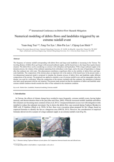
Numerical modeling of debris flows and landslides triggered by extreme rainfall event
The frequency of extreme rainfall corresponding with debris flows and large-scale landslides is increasing in the Taiwan. The traveling distance of debris flows get longer with increased sediment supply, and the hazard area is also larger than regular disaster situation. The debris flows can be considering as a mixture with solid phase and liquid phase. With a larger sediment supply in the dynamic process, the volume of fine sediment separating from solid phase is also larger, and so the state of liquid phase is change after fine sediment mix with water. This phenomenon contributes a significant effect on the mobility of debris flows and large- scale landslides. The composition of the mixture plays an important role in the analysis of the hazard area. In the present study, a two-dimensional numerical model is proposed to simulate the dynamic process of debris flows and landslides under different compositions of the mixture. The proposed was applied to simulate a case of extreme rainfall event, and the topographic data after disaster was used for verification. When the composition of the mixture included with fine sediment, the simulation of affected area had a good agreement with the real situation. The present study pointed out that the simulation of debris and landslide under extreme rainfall condition should consider the effect of fine sediment in the simulation condition.
114
Debris flow building damage level and vulnerability curve: a case study of a 2015 typhoon event in northern Taiwan
Physical vulnerability of the building is the key element for debris-flow hazard Quantitative Risk Analysis (QRA). Most vulnerability curves were related to the deposition height (Fuchs et al., 2007; Lo et al., 2012), or the combination of deposition height, velocity, and impact force (Quan Luna et al., 2011; Jakob et al., 2012; Kang and Kim, 2016). This study uses datasets obtained from a debris-flow hazard caught on video in northern Taiwan during a 2015 Typhoon event and compare with the existing building damage classes and vulnerability curves. The deposition heights, ranging from 0.1 to 5-m, and damage levels of the 15 houses were carefully documented. Of these 15 reinforced-concrete, reinforced-brick, and brick houses, 7 were considered as totally destroyed judging by their actual damage level, others sustained various damages. The debris-flow velocity and impact force were simulated with RAMMS
115
Estimating mechanical slope stability to predict the regions and ranges of deep-seated catastrophic landslides
In Japan, Typhoon Talas (T1112) induced many rapid deep-seated landslides in the Kii Peninsula. A landslide is one of main processes associated with debris flow initiation. In particular, deep-seated catastrophic landslides can lead to large-scale debris flows that seriously impact human welfare. Previous studies have explored the roles played by geology and geological structure. However, no single, widely used physical model is employed to analyze such landslides. Here, we focus on slope scale and gradient, and explore the relationship between height and gradient for several slopes. We found that the height of slopes exhibiting various gradients was limited, where the greater the gradient, the lower the height; the relationship was amenable to slope stability analysis. We developed a physical model of deep-seated landslides and identified regions at risk. We focused on slopes where typhoon Talas caused such landslides and used detailed topological (LiDAR) data collected before and after the typhoon to measure slope gradients and relative heights. Our model effectively localized deep-seated landslides, although we assumed that the strength of weathered rock was uniform throughout the study area, based on data on the side-slope gradients and relative heights of land abutting the Totsugawa River.
116
Multi-scale hazard assessment of debris flows in eastern Qinghai-Tibet Plateau area
Process analysis and hazard assessment are essential for the prevention and mitigation of debris-flow hazards in mountainous areas. Many villages and ongoing infrastructure projects in China are vulnerable to large debris flows during heavy rainfall or glacier lake outbursts. Without emergency management planning, such contingencies can lead to extensive loss of life and egregious property damage. In the eastern Qinghai-Tibet Plateau area, debris-flow disasters are a common phenomenon. In this article, we analyzed the spatial distribution, activity and hazard characteristics of debris flows and established a debris-flow database by using geographic information technology. Moreover, we comprehensively analyzed the dynamic process of debris flow at a local scale, the compound effects of debris flows along riverside section and the disaster environment factors of debris flows overall scale of Sichuan-Tibet highway respectively. Accordingly, we built an applicable factor system and a comprehensive framework to quantitatively evaluate debris-flow hazard degree, and then proposed a multi-scale debris-flow hazard assessment method by analyzing typical large-scale debris-flow hazard, debris flows along riverside highway and debris flows in whole traffic corridor, respectively. Especially, with respect to typical large-scale debris-flow disaster, we proposed a dynamic process-based method to analyzed debris-flow hazard by using numerical simulation of debris flow, flood analysis, RS and GIS technology. In view of debris flows along riverside highway, we analyzed debris flow process and determined the hazard evaluation indexes and proposed a quantitative method of hazard assessment for debris flow along riverside highways. Regarding to debris flows along whole road, we proposed a quantitative method to analyze the hazard of debris flows and classified hazard levels in the debris- flow prone area along highways. Finally, these proposed methods were applied in case studies in a local scale (K3404 of G318), Xiqu river section and Sichuan-Tibet highway respectively. The results showed that the calculated risk zones consist with the actual distribution and severity of damage of the debris- flow events, which can provide scientific reference for debris-flow risk management and disaster prevention and mitigation of arterial traffic lines.
117
Preliminary calibration of a numerical runout model for debris flows in southwestern British Columbia
Debris-flow hazard and risk assessments require reliable estimates of inundation area, velocity and flow depth to evaluate spatial impact and impact intensity. Semi-empirical numerical runout models that simulate bulk flow behavior with simple rheological models are useful in forecasting these parameters, however, they require calibration by back-analyzing past events. This paper presents the back-analysis of six debris flows in southwestern British Columbia using a novel automated calibration approach that systematically optimizes the Dan3D runout model to fit field observations. The calibration method yielded good simulations of runout length, but under-predicted flow depths in some cases, and over-predicted velocities in all cases. The best-fit Voellmy rheology parameters for the studied cases ranged from 46 to 531 m/s2 for the turbulence coefficient and 0.08 to 0.18 for the friction coefficient. There is a potential inverse correlation between friction coefficient and event volume. Calibrated parameters were compared to morphometric parameters for the study sites, which may be useful for guiding parameter selection once a larger dataset is calibrated. Ongoing work is focused on refining the calibration technique, including standardization of input parameters more relevant to debris flows. The long-term goal is to apply the technique to a larger dataset of debris-flow cases and provide practitioners with better guidance on the selection of model input parameters for forecasting purposes.
118
Predicting debris-flow scour depth downstream from a check dam
Debris flows often pose great threats to people’s lives and property in mountainous regions. For example on August 8, 2010, a debris flow with a volume of 220×104 m3 occurred in ZhouQu county, Gansu province, China. The debris flow resulted in not only significant loss of farmlands, but also in 1,248 deaths and 496 people missing. The construction of check dams in debris- flow valleys is a useful way to mitigate deaths and damages. Herein, we investigate scour downstream from check dam spillway structures. We propose that the main parameters which determine scour depth of a scour hole downstream from check dams, include flow density, flow depth, flow discharge per unit width, and acceleration due to gravity. Physical experiments were also carried out to investigate debris flow movement and scour characteristics. In addition, a theoretical expression was deduced to predict the maximum scour depth downstream from check dams. There was a good correlation between experimental data and results predicted from theory. The results obtained in this paper can provide constraints for the design of check dams in mountainous areas.
119
Debris-flow mitigation measures and an application case in a small-scale watershed in China
The Wenchuan earthquake in China (May 12, 2008) triggered numerous debris flows, some of which caused serious secondary disasters, such as in Wenjia gully (Sichuan Province) and Sanyanyu gully (Gansu Province). To solve this problem, a planning method for debris-flow mitigation engineering measures was proposed based on watershed and river sediment transport characteristics. This method aids in the selection of engineering measures to effectively prevent secondary disasters and control unconsolidated soil and debris-flow movement from upstream to downstream. Several measures are considered in the proposed method, including check dams and transverse structures built across gullies, which are important engineering measures in debris- flow hazard mitigation. Based on the developed planning method, new types of check dams were proposed, the regulation effect of sediment particle size in slit check dams was qualitatively analyzed, and the design parameters (e.g., deposition slope, deposition length, and dam height) of the check dams were deduced. Moreover, a series of drainage channels was proposed to cross highways and discharge debris flows into the river or debris-flow deposition basin below. Finally, an engineering application case in Xiaogangjian gully, Sichuan Province, China, was examined using the proposed watershed planning method, in which a series of check dams with different orifices sizes was constructed. The engineering application results provide useful data for developing check dams as a restoration tool and hazard mitigation technology in small watersheds.
120
Roles of barrier location for effective debris flow mitigation: assessment using DAN3D
Debris flows can travel at rapid velocities and can cause economic and societal damages. Accordingly, barriers that can dissipate the energy of debris flows are frequently installed as a mitigation measure. However, the effect of barriers on debris-flow behavior is not fully understood. In this study, we used DAN3D to investigate the interactions between a debris flow and barriers, and evaluate the effect of barrier location on debris-flow velocity and volume. We chose a study site in Seoul, Korea, where a debris- flow event occurred in 2011. At the site, we numerically installed a closed-type barrier at four different locations along the flow path in the watershed. We then simulated the debris flow while monitoring debris-flow velocity and volume. The barriers decreased the velocity and volume of the debris flow compared to a simulation with no barrier. In particular, installation of the barrier at the upstream portions of watersheds resulted in the greatest reduction in velocity. Installation of the barrier at downstream portions of watersheds resulted in the greatest deposition of volume. These results contribute to a better understanding of debris-flow behavior associated with the installed barriers as a mitigation measure, and can be used for optimum and efficient design of the debris-flow barriers.
121
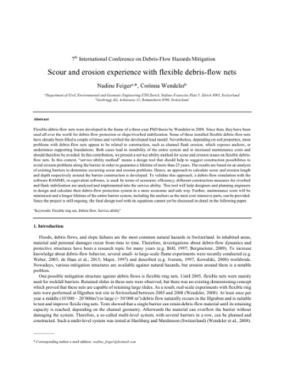
Scour and erosion experience with flexible debris flow nets
Flexible debris-flow nets were developed in the frame of a three-year PhD thesis by Wendeler in 2008. Since then, they have been used all over the world for debris-flow protection or slope/riverbed stabilization. Some of these installed flexible debris-flow nets have already been filled a couple of times and verified the developed load model. Nevertheless, depending on soil properties, most problems with debris-flow nets appear to be related to construction, such as channel flank erosion, which exposes anchors, or undermines supporting foundations. Both cases lead to instability of the entire system and to increased maintenance costs and should therefore be avoided. In this contribution, we present a service ability method for scour and erosion issues on flexible debris- flow nets. In this context, “service ability method” means a design tool that should help to suggest construction possibilities to avoid erosion problems along the barrier in order to guarantee a lifetime of more than 25 years. The results are based on an analysis of existing barriers to determine occurring scour and erosion problems. Hence, an approach to calculate scour and erosion length and depth respectively around the barrier construction is developed. To validate this approach, a debris-flow simulation with the software RAMMS, or equivalent software, is used. In terms of economic efficiency, different construction measures for riverbed and flank stabilization are analyzed and implemented into the service ability. This tool will help designers and planning engineers to design and calculate their debris-flow protection system in a more economic and safe way. Further, maintenance costs will be minimized and a longer lifetime of the entire barrier system, including the anchors as the most cost-intensive parts, can be provided. Since the project is still ongoing, the final design tool with its equations cannot yet be discussed in detail in the following paper.
122
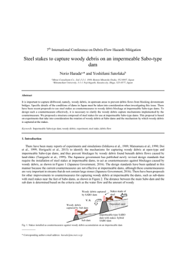
Steel stakes to capture debris-wood on an impermeable Sabo-type dam
It is important to capture driftwood, namely, woody debris, in upstream areas to prevent debris flows from blocking downstream bridges. Specific details of the conditions of dams in Japan must be taken into consideration when investigating this issue. There have been recent proposals to use steel stakes as countermeasures to woody debris blockage at impermeable Sabo-type dams. To design such a countermeasure effectively, it is necessary to clarify the woody debris capture mechanisms implemented by the countermeasure. We proposed a structure composed of steel stakes for use at impermeable Sabo-type dams. This proposal is based on experiments that take into consideration the rotation of woody debris at Sabo dams and the mechanism by which woody debris is captured at the stakes.
123
Debris flow mitigation – research and practice in Hong Kong
Dense urban development on a hilly terrain, coupled with intense seasonal rainfall and heterogeneous weathered profiles, gives rise to acute debris flow problems in Hong Kong. The Geotechnical Engineering Office (GEO) of the Hong Kong SAR Government has launched a holistic R&D programme and collaborated with various tertiary institutes and professional bodies to support the development of a comprehensive technical framework for managing landslide risk and designing debris flow mitigation measures. The scope of the technical development work includes compilation of landslide inventories, field studies of debris flows, development and calibration of tools for landslide runout modelling, back analysis of notable debris flows, physical and numerical modelling of the interaction of debris flow and mitigation measures, formulation of a technical framework for evaluating debris flow hazards, and development of pragmatic mitigation strategies and design methodologies for debris flow countermeasures. The work has advanced the technical understanding of debris flow hazards and transformed the natural terrain landslide risk management practice in Hong Kong. New analytical tools and improved design methodologies are being applied in routine geotechnical engineering practice.
124
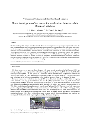
Flume investigation of the interaction mechanisms between debris flow and slit dams
Slit dams are designed to mitigate debris-flow hazards. However, according to field surveys and past experimental studies, slit dams constructed using currently prescribed design methods usually become blocked, which then leads to the loss of capacities of the slit dam’s capability to mitigate debris-flow hazards. In this study, a series of flume tests were conducted to investigate the interaction mechanisms between debris flows and slit dams. This work aims to contribute to the design of slit dams more reliable. The influence of debris-flow water content (w) and the slit-dam relative post spacing b/dmax (b: post spacing; dmax: maximum particle diameter) were examined. Experimental results reveal that when w<22%, dead zones and pile-ups occur during the interaction processes. When w≥22% and b/dmax≤2.3, run-up, overtopping, and backwater effects can be observed, and with no apparent formation of dead zones. Moreover, when w≥26% and b/dmax>2.3, majority of the granular-water mixtures pass through the slit dam in the form of jet flows with no obvious overtopping.
125
Empirical model for assessing dynamic susceptibility of post-earthquake debris flows
Debris-flow susceptibility is controlled not only by static effective factors such as topography and lithology, but also by dynamic effective factors such as earthquake, rainfall and human activity. In this paper, a simple model of calculating the dynamic susceptibility is developed based on the assumption of linear relationship between the static and dynamic susceptibilities. The influence of earthquake and rainfall events is represent by two coefficients. The earthquake coefficient is considered as an exponential function of intensity, and a negative power function of elapsed time. The rainfall coefficient is proportional to the occurrence days of heavy rainfall. This model is applied to assess the debris-flow susceptibility of Hengduan mountainous area from 2000 to 2015. Four static effective factors including relative relief, slope, lithology and fault density are used to calculate the static susceptibility by ARCGIS grid toolbox. There are six earthquake events since 1995 whose intensity zones of >= VI are intersected with the Hengduan area. The earthquake coefficient is calculated with the intensity zoning data of each of the six events and then is accumulated to get the final earthquake coefficient in each year. TRMM satellite rainfall data from 2000 to 2015 are collected to extract the occurrence days of heavy rainfall which is used to calculate the rainfall coefficient. The dynamic susceptibilities from 2000 to 2015 are obtained by multiplying the static susceptibility with the earthquake and rainfall coefficients in respective year. The 2015 susceptibility map shows a qualitative agreement with the distribution map of disasters in 2015.
126
From practical experience to national guidelines for debris flow mitigation measures in Austria
In the second half of the 19th century a lot of torrential disasters occurred in the Alps causing substantial damage. These catastrophes may be traced back to non-sustainable land-use management with inadequate alpin pasture farming, leading to forests in a poor condition, large denuded areas and steep incised channels. Starting with an analysis of these disasters, political decisions were made to implement mitigations measures, including forestry, agricultural and structural measures. Additional financial regulations were established to facilitate mitigations measures even for poor rural communities. The technological background for the design of structural measures was founded in forestry, because of the experience with construction of log driving. Basic hydraulic models were used for designs, sometimes empirical values were added to consider bedload or the impact of point loads. The structures served to stabilize the channel bed, to deposit bedload upstream of settlements, to restrict sedimentation or inundation on the fan or to redirect the flow to areas of low interest. In the early years of torrent control in the Alps, structures were usually built as dry masonry walls, later cement mortar masonry walls and concrete gravity walls were favoured. New static concepts and the use of reinforced concrete formed the basis of a colloquium in Vienna (1973), where load models and static concepts were discussed. In practice, the multiplier of the static load of the Lichtenhahn-model was used within a broad range, leading to different structural design of check-dams. In the beginning of the 21th century, based on the design concept of EUROCODE, new technical guidelines for barrier design (ONR-Series 248xx) were developed. The load cases include flood and debris-flow and combination of events for all kind of torrential structures. The experience in the application of these guidelines is currently being evaluated and will lead to a new national standard.
127
Flexible debris-flow nets for post wildfire debris mitigation in the western United States
Wildfires are a continual threat in the western United States. Post-fire debris flows annually cause millions of dollars in damage and often result in loss of life. Rapid post-fire response is essential to prevent additional hazards in terms of debris-flow damages. Flexible systems utilizing high-strength steel ring nets have proven to be reliable and cost effective. These systems can be installed rapidly to minimize or eliminate the dangers caused by post-fire debris flows. Wildfires in the western United States generally occur during the dry season in late summer and fall. Although monsoonal storms can cause debris flows in the summer months, seasonal rain storm events occur in fall and winter, often resulting in devastating debris flows. In the Rocky Mountain states debris flows occur during the summer monsoon season. In both areas, storm cells can remain stationary over mountain peaks for hours dropping large amounts of rain in a very short time. The resulting runoff and erosion can cause damaging debris flows miles away from the rain event. Debris impacts differ significantly from rockfall impacts. The debris nets must withstand both a surge in pressure on impact, and a static load once the flow has dissipated. Tested and engineered, flexible nets can be rapidly deployed in strategic locations to lessen or eliminate the threat. Compared to large, rigid structures and debris basins, these nets are cost-effective, rapidly constructed, environmentally friendly, and approval by regulatory agencies can relatively quick. This study focuses on current mitigation and protection practices using flexible debris-flow nets as developed in Switzerland and used in the United States. Case studies of projects in Colorado, New Mexico, and California detailing site investigations, engineering, and construction of flexible debris-flow nets are described. Of special interest are the steps and protocols taken as a result of debris flows following the Thomas Fire in California.
128
Application of an innovative, low-maintenance weir to protect against debris flows and floods in Ottone, Italy
The need of a low-maintenance and easy-applicable apparatus against debris flow led Maccaferri Innovation Center and the Politecnico of Milan to a new hydraulic-based approach that was focused on the application of a special weir called Mini Skirt Check Dam (MSCD). After a three-years research on applicable equations, a construction site in Ottone (Italy) was identified to have been affected by destructive debris flow in the past years. The site is characterized by the presence of an underground pipe that collects the stream flow rate flowing under the village square. The purpose of this work is to design a MSCD, able to prevent a pressure driven flow in the underground pipe and to avoid the related risk for the inhabitant of the village. MSCD is a special weir, which consists in large wings to slow the flow and a ring net to block boulders and logs, as to become a sifting filter of the debris. As to design the best performing apparatus, materials and type of anchoring are crucial; for this reason, an analysis of the impact pressure was performed. The case study has considered several different aspects: hydrology, size of the material and its characteristics and previous events to have a complete analysis of what could happen in the next events. The result of this collaboration is the complete design of a MSCD, ready to be installed.
129
Laboratory tests of an innovative check dam
The flow of both solid and liquid particles, especially in mountain basins, is impulsive, not easily predictable and for this reason extremely dangerous. As to avoid the damages caused by this phenomenon, barriers are usually used. They are easy to install but are high maintenance and, in addition, they are aimed at blocking all the sediment, running the risk of under-designing the volume to be collected. Starting from this assumption, the need of a maintenance-friendly approach was investigated by Maccaferri Innovation Center with an innovative apparatus called Mini Skirt Check Dam (MSCD). This is a special dam which is made up of two parts: solid wings that have a vertical fissure in which a ring net is applied. The net is uplifted from the ground as to leave a part of the debris flowing and blocking only the top part of it. The research analyzed the design procedure of a standard weir and several laboratory tests were performed in cooperation with the University of Trento (Italy) that ended with the creation of a new approach against debris flow. The MSCD permits the cutting of the peak of the flow rate and, at the same time, blocking tree trunks and boulders. Laboratory tests conducted showed that the combination of weir and net slows down the debris and collects only the most dangerous part of the flow with a lower maintenance requirement and a good hydraulic performance.
130
Numerical study of debris flows in presence of obstacles and retaining structures: a case study in the Italian Alps
Debris flows are one of the most frequent mass movement processes and occur in all regions with steep relief and at least occasional rainfall. Their high flow velocity, impact forces, and long runout, combined with poor temporal predictability, cause debris flows to be one of the most hazardous landslide types. An essential aspect of debris-flow risk management is the design of mitigation measures, which reduce the existing risk to an accepted level of residual risk, by reducing the potential damage that the moving mass can produce in terms of loss of human life and destruction of structures and infrastructures. Among these mitigation measures, transverse retention structures are used to delimit storage basins and prevent dangerous debris flows from reaching high- consequence areas. Due to the enormous impact forces that debris flows can exert on obstacles in their path, a reasonable planning requires that dynamic stresses are taken into account during the structural designing process, regardless of the complete (solid body barrier) or partial (open barrier) retention function that the type of selected structure can exert on the flowing mass. Since the village of Cancia, close to Cortina d’Ampezzo (Italian Dolomites), is hit by destructive debris flows for a long time, a storage basin delimited by natural and gabion barriers was built in 2000. In 2009 a severe event caused the partial collapse of the gabions and the overflow of the flowing mass. The present paper analyses through numerical modelling the dynamics of the flow and the influence of an abandoned building, existing inside the storage basin, on the occurred event.
131
Design of a debris retention basin enabling sediment continuity for small events: the Combe de Lancey case study (France)
The Combe de Lancey stream is a relatively calm tributary of the Isère River flowing through the city of Villard-Bonnot near Grenoble (France). In 2005, a long-lasting extreme rainfall event triggered dramatic erosion processes in this 18 km² granitic catchment. A volume of 20,000 m3 of sediment and logs deposited in the paper factory located near the fan apex. This paper focuses on the definition of a new protection system, namely a debris retention structure made of an excavated basin and an open check dam. The design is based on expert knowledge and tested byphysical small scale modelling. The particularity of this case study relies on two points: (i) its design scenarios and (ii) the structure capacity to transfer small events. Attention was paid to define several 100-year return period events used as “design events” for which the structure must have its best effectiveness. Extreme events with higher return periods called “safety check events”, for which the structure must still withstand the event without failure but with acceptable marginal damages, were also modeled. The definition of the scenarios is described in the paper. Secondly, the debris retention basin should have the capacity to transfer small debris floods without trapping sediment in order to prevent downstream incision and heavy maintenance costs. It must however trap nearly totally the sediment and large woods that are erratically supplied by the catchment during extreme events. Classical debris retention basins are usually not able to achieve such a dual objective. Here, two concepts developed in past works, namely a guiding channel and a hybrid open check dam with mechanical – hydraulic control were successfully tested. The paper presents the design and testing procedure of this case study exemplifying the next generation of debris retention structures.
132
Review of the mechanisms of debris-flow impact against barriers
Our limited understanding of the mechanisms pertaining to the force exerted by debris flows on barriers makes it difficult to ascertain whether a design is inadequate, adequate, or over-designed. The main scientific challenge is because flow-type landslides impacting a rigid barrier is rarely captured in the field, and no systematic, physical experimental data is available to reveal the impact mechanisms. An important consideration in flow-structure interaction is that the impact dynamics can differ radically depending on the composition of the flow. Currently, no framework exists that can characterize the impact behavior for a wide range of flow compositions. This review paper examines recent works on debris-flow structure interactions and the limitations of commonly used approaches to estimate the impact load for the design of barriers. Key challenges faced in this area and outlook for further research are discussed.
133
Small scale impact on rigid barrier using transparent debris-flow models
Fast landslides, such as debris flows, involve high speed downslope motion of rocks, soil and water. Their high flow velocity, high degree of runout and potential for impact make them one of the most hazardous gravitational mass flows. While the estimation of the pressure generated by the impact of debris flows on civil engineering structures has been widely investigated, the state of the knowledge is still insufficient to accurately describe the dynamics and load evolution of the impact process. Both fluid and solid forces influence the dynamics of debris flows but existing design approaches for barrier or mitigation structures tend to treat these geophysical flows as a single continuum, neglecting the solid fluid-interactions. Hence in the literature, impact models are yet largely semi-empirical. This paper presents the first results of experiments using transparent debris flows in a small-scale flume aiming at investigating the mechanism of impact on rigid barriers. The use of a transparent debris-flow model allows the movements of particles and fluid within the medium to be probed. We examine flows consisting of uniform and well graded particle size gradings at two different fluid contents. The evolution of the impact load, bed normal pressure and fluid pore pressure for the different flows are measured and analysed in order to gain a quantitative comparison of their behaviour before and after impact.
134
Estimation of temporal changes of debris flows and hydraulic model tests of channel works with multi-drop structures
A debris-flow disaster took place in the Nashizawa creek in Kiso River catchment, Nagano Prefecture, Japan on 9th July 2014 due to intensive rainfall from the typhoon Neoguri. There were few data available for estimation of debris-flow discharge in the catchment. A CCTV camera and a high sensitivity seismometer were installed along Nashizawa creek prior to the debris flows. Surges of debris flows were recorded by CCTV camera, though the camera was eventually destroyed by those surges during debris flows. The shape of debris-flow surges was estimated using the discharge analysed by CCTV camera data and fitting curve of relations between debris-flow discharge and acceleration of vibration. Peak discharge was extrapolated from peak acceleration of the vibration, and was estimated about 756 m3/s. At the Nashizawa creek, channel works with multi-drop structures were planned for construction after the debris-flow disaster. Some research was conducted experimentally for planning and design of channel works such as multi-drop structures. This research pointed out several problems for multi-drop structures in supercritical flow such as scouring and flow depth increases due to shock waves. We investigated characteristics of shockwaves and countermeasures using multi-drop structures in a steep channel with supercritical flow experimentally to design the channel works. We found that stair-type dissipaters are effective for mitigating shockwaves from multi-drop structures.
135
Debris-flow hazards mitigation: mechanics, monitoring, modeling, and assessment; proceedings of the Seventh International Conference on Debris-Flow Hazards Mitigation, Golden, Colorado, USA, June 10-13, 2019
The Seventh International Conference on Debris-Flow Hazards Mitigation was held in Golden, Colorado, June 10-13, 2019. The major objective of the conference was to provide a forum for international researchers, engineers, and policy makers to exchange ideas and promote communication to advance the scientific understanding of debris-flow hazards as well as approaches to assess and mitigate debris-flow risk to infrastructure and people.–from page iii of proceedings.